Lhasa, as the capital of the Tibet Autonomous Region and a sacred city of Tibetan Buddhism, is an ancient plateau city that blends profound historical heritage with modern urban functions. Its unique urban layout radiates outward from the Potala Palace and Jokhang Temple, forming a city structure with clearly divided religious, administrative, commercial, and residential functions. Understanding the Lhasa city map is not only about convenient travel but also about deciphering the city’s historical context, cultural fabric, and contemporary development. This article will provide an in-depth analysis of Lhasa’s urban area divisions, three-dimensional transportation networks, distribution of core landmarks, and practical navigation information, offering an effective assistance in traveling to Lhasa.
Overview of Lhasa’s Urban Functional Areas: Essential Knowledge for Visiting the City
Detailed Guide to Lhasa City District Distribution
Lhasa’s urban area can be divided into several functional, distinct, and characteristic districts. Understanding the positioning of these areas is the foundation for effectively using the map.
- Ancient City Core Area: Includes Jokhang Temple and Barkhor Street, approximately 1.5 kilometers in total length, along with densely packed alleyways.
- Potala Palace and Administrative-Cultural District: Encompasses the Potala Palace, Potala Palace Square, the People’s Government of the Tibet Autonomous Region, the Lhasa Municipal People’s Government, the Tibet Museum, and Norbulingka. This area is the cultural heart of Lhasa.
- Commercial and Modern Living District: Centered around Yutuo Road Pedestrian Street, this is Lhasa’s most bustling modern commercial area, featuring large shopping malls, brand stores, banks, cinemas, various dining options, and modern hotels.
- Eastern Suburb New District: Primarily includes Lhasa’s transportation hubs, such as Lhasa Railway Station and the Long-Distance Bus East Station. Educational institutions like Tibet University and the Tibet Tibetan Medical College are also located here. This district serves as a crucial gateway to and from Lhasa.
- Tuanjie New Village Area: A residential district in Lhasa with a strong local atmosphere, home to numerous characteristic restaurants.
These areas cover the must-visit places and key transportation routes in Lhasa. It is recommended to plan your routes in advance.
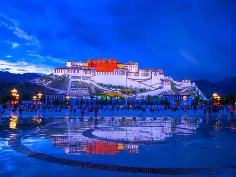
Night View of the Potala Palace
Core Transportation Networks and Hub Locations
Lhasa’s urban roads revolve around several key arteries. .
- Beijing Road: The absolute east-west arterial road, divided into Beijing East Road, Beijing Middle Road, and Beijing West Road. It functions like a spine, connecting the railway station (east), commercial areas (central), the Potala Palace (central), and Norbulingka (west). It has the densest bus routes along its length.
- Jiangsu Road: Another important east-west trunk road, running parallel to and slightly south of Beijing Road, serving as the main route to Lhasa Bridge and the Eastern Suburb New District.
- – Lingkor Road: A circular road around the periphery of Lhasa’s old city, traditionally the outer pilgrimage circuit (Lingkor). For self-driving or vehicular travel, it is a vital route to bypass congested areas in the ancient city center
- Niangre Road, Sera Road, Jinzhu Road, etc.: Important north-south connecting roads leading to various directions in the suburbs (e.g., Niangre Road leads to Sera Monastery).
In addition, you should pay attention to Lhasa’s public transportation, which can help you save significantly on expenses.
- Main Bus Terminals/Hubs: Primarily located near Chongsaikang (close to Jokhang Temple), the Civil Aviation Administration (on Niangre Road), and the western suburbs. On the map, note that bus routes are mostly circular or radial, covering main roads and attractions.
- Taxi and Ride-Hailing Hotspots: Areas around Potala Palace Square, both ends of Yutuo Road Pedestrian Street, and near major hotels and hospitals are the most concentrated areas for taxis. Using mobile map apps to hail ride-hailing services is very common in Lhasa, but precisepositioning to prominent landmarks is recommended.
Major Transportation for Travel to and from Lhasa: Key Modes of Transport to Focus On
Travel to and from Lhasa primarily relies on these key entry/exit points and long-distance transportation hubs, distributed as follows.
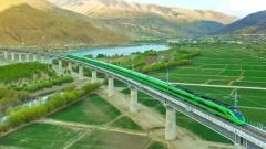
- Lhasa Railway Station: Located in the Liuwu New District in the southeastern part of the city. On the map, it is connected to the main urban area via Lhasa Bridge or Yingqin Bridge. The station square hasdense transportation (Bus routes 1, 13, 14, etc.) that takes you to anywhere you want.
- Lhasa Gonggar International Airport: Located about 60 kilometers southwest of the city center in Gonggar County, Shannan City. Airport shuttle buses usually terminate at the “Civil Aviation Administration Ticket Office” (on Niangre Road), which is a very important transportation transfer point on the map.
- Long-Distance Bus Stations: Mainly include the East Suburb Bus Station (for routes to Shigatse, Nyingchi, etc., in the east), North Suburb Bus Station (for routes to Nagqu, Golmud, etc., in the north), West Suburb Bus Station (now less frequently used), and Liuwu Bus Station (near the railway station). Accurately locating these stations on the map is crucial for planningto travel surrounded areas.
Mastering the above information will greatly assist you in planning your time and ways for the travel.
Distribution Map of Major Attractions and Cultural Landmarks
The distribution of attractions in Lhasa follows a distinct pattern of “one heart, one axis, multiple points.” .
- Jokhang Temple – Barkhor Street (The Heart): With Jokhang Temple as the center point, the first outward circle is Barkhor Street, densely packed with historical and cultural sites such as Makye Ame Restaurant, theformer site of the Qing Dynasty Amban’s Office, and the Gedun Choephel Memorial Hall. Every alley along the pilgrimage circuit may lead to an ancient temple.
- Potala Palace (The Axis): The highest point and visual focus on the map. From here, attractions include Chakpori Hill Viewpoint (southwest of the Potala Palace), Zongjiao Lukang Park (Dragon King Pond), and the Tibet Museum.
- Sera Monastery (Multiple Points): Nearby attractions include Drepung Monastery, Ganden Monastery, Ramoche Temple, etc.
- Recommended Route: Scenic Area Entrance → Mirror Lake → Five-Flower Lake → Nuorilang Waterfall → Long Lake → Five-Color Pond
You can follow the sequence of “one heart, one axis, multiple points” to explore Lhasa.
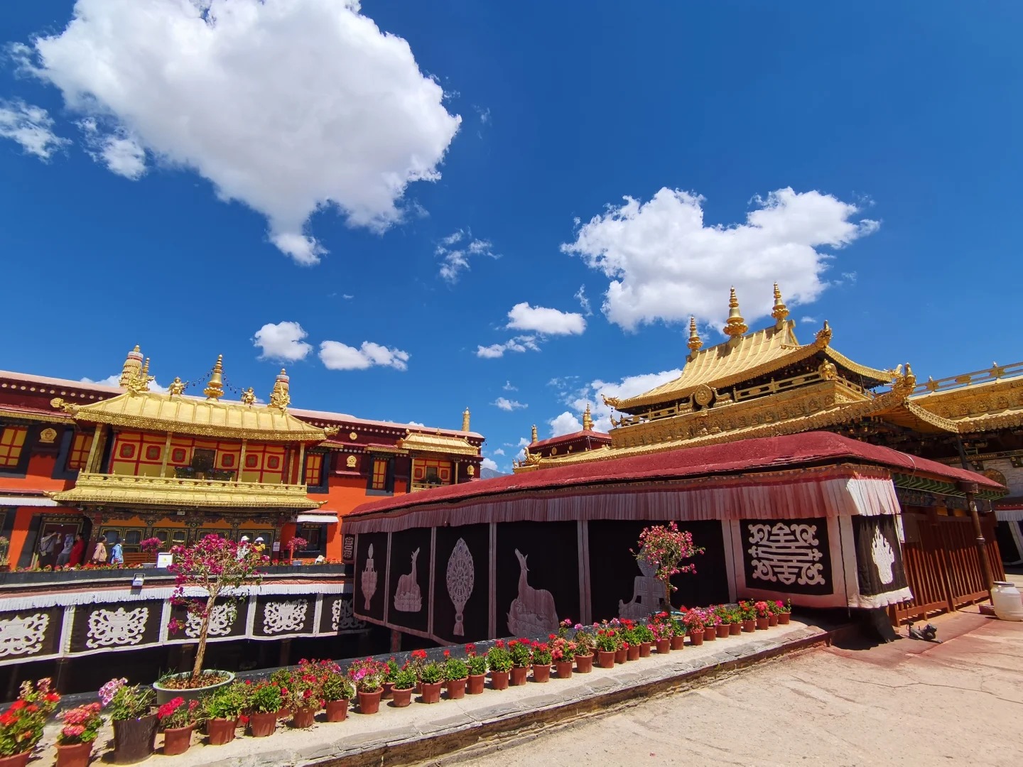
Jokhang Temple
5. Practical Map Usage and Navigation Tips
Choosing the right map tools is essential for travel, as it is key to saving time and improving efficiency.
- Paper Maps: Upon arriving in Lhasa, purchasing a detailed tourist map (usually available at newsstands or hotels) helps establish abroadsense of direction. Good tourist maps clearly mark attractions, important institutions, and recommended dining and accommodation
- Mobile Map Apps: Gaode Maps and Baidu Maps offer excellent accuracy and update speed within Lhasa city, making them thenumber one choice for real-time navigation. Be sure to download the offline map package for “Tibet Autonomous Region” or “Lhasa City” in advance to cope with unstable mobile networks in some areas.
- Professional Navigation Devices: For travelers self-driving to remote areas like Ngari or Nagqu, it is recommended to equipprofessional satellite navigation equipment (such as Garmin) and update to the latest maps..
Precautions for Lhasa Map Navigation
Alleyways in the ancient city core area are mostly one-way streets or pedestrian zones. When driving, strictly follow traffic guidance. Some roads around the Potala Palace may also implement traffic control during specific times, so pay attention to map and navigation prompts. Maps and road signs typically feature Chinese, Tibetan, and English. However, locals may be more accustomed to using Tibetan place names, so it is best to show the Chinese name on the map when asking for directions. In Lhasa, the Potala Palace is the most prominent and reliable reference. As long as you can see the Potala Palace, you can quickly judge your general location and direction. In old city areas like Barkhor Street, GPS signals may be somewhat disturbance due to narrow alleys and high walls, causing occasional delays in pedestrian navigation. In such cases, “following the flow of pilgrims” or “using the golden roof of Jokhang Temple as the target” is the most reliable way for your location.
Summary of Practical Life Information for Lhasa
The following are the distribution locations of some public facilities in Lhasa city.
- Medical Institutions: Tibet Autonomous Region People’s Hospital (on Lingkor North Road) and Lhasa Municipal People’s Hospital (on Beijing East Road) are the main comprehensive hospitals. Their locations should be marked on the map for emergencies.
- Postal and Banking Services: China Post (with larger branches on Yutuo Road and Beijing Middle Road) offers postcard mailing services. Branches and ATMs of major banks (Bank of China, Agricultural Bank of China, China Construction Bank, etc.) aredensely locatedalong Yutuo Road and Beijing Middle Road.
- Supermarkets and Markets: Baiyi Supermarket (on Yutuo Road) and Hongqi Supermarket (multiplesupply-chain locations) are great places to purchase daily necessities and supplies.
A detailed Lhasa map is not just a tool for guiding direction but also a key to interpreting this sacred city on the plateau. From the core Barkhor Street to the magnificent Potala Palace axis, from the crisscrossed modern arteries to the intertwining ancient alleyways, every line and point on the map tells a story. Familiarizing yourself with Lhasa’s urban layout in advance and skillfully using online and offline navigation tools will make your journey easy and unhurried. Remember, in Lhasa, the best exploration sometimes stems from a clear map and a tranquil mind, allowing you to truly understand the city’s unique charm as you walk between pilgrimage circuits and modern streets.