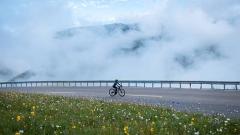
As the birthplace of Tibetan culture, Shannan Tibet features towering snow-capped mountains and sacred lakes, attracting numerous tourists. Shannan Tibet’s altitude is a key factor affecting travel experience, with huge differences from 3,700m river valleys to 7,554m Mount Kuragangri, requiring physical acclimatization. This guide, compiled for tourists, covers core scenic spot altitudes, altitude sickness response and itinerary planning to ensure a smooth trip.
Overview of Shannan Tibet Altitude: Topographic Background of Tibetan Origin
Shannan is located in the middle and lower reaches of the Yarlung Zangbo River south of the Gangdise Mountains to the Nyainqêntanglha Mountains on the Qinghai-Tibet Plateau. Its terrain slopes from south to north and from west to east, belonging to the high-altitude broad valley zone between the Gangdise Mountains and the Himalayas. This unique terrain has created a significant difference in altitude distribution. The core information is as follows:
- Overall Altitude Range: Most areas are between 3,500 meters and 4,500 meters above sea level, with an average altitude of 3,700 meters
- Regional Altitude Difference: The average altitude in the southwest reaches 4,500 meters, while the average altitude in the northeast is relatively low, about 3,100 meters
From the perspective of extreme data and tourism relevance:
- Highest Altitude: Mount Kuragangri, at 7,554 meters, forms a magnificent snow-capped mountain landscape with 6 other peaks above 7,000 meters nearby
- Lowest Altitude: Subansiri River Valley, only 110 meters above sea level. Part of it is in the area controlled by India and is not accessible by regular tourist routes
- Core Concerned Altitude for Tourists: The altitude of core tourist areas is concentrated between 3,200 meters and 5,300 meters, which directly affects the local climate, landscape and travel difficulty, and is an important basis for itinerary planning
Langkazi County, Lhoka, Tibet
Core Tourist Areas: Travel Shannan with Altitude in Mind
Shannan’s tourism resources are mainly concentrated in cultural scenic spots around Tsetang Town, sacred lake scenic spots such as Yamdrok Lake, and snow-capped mountain hiking areas such as Mount Kuragangri. Different areas have different altitude characteristics, and the travel experience and precautions also vary. The following is a detailed explanation of the altitude of each core area in Shannan Tibet and corresponding travel suggestions to help tourists accurately plan their itineraries.
Tsetang Town and Surroundings: Low-Altitude Entry Point
As the administrative center of Shannan City, Tsetang Town is the first stop for most tourists entering Shannan. The relevant altitude advantages and altitude information of surrounding scenic spots are as follows:
- Altitude of Tsetang Town: 3,560 meters, which is a relatively mild altitude area in Shannan Tibet, suitable as a transition zone for acclimatizing to the plateau environment
- Core Surrounding Scenic Spots: Key Tibetan cultural sites like Yongbulakang Palace, Samye Monastery (3,500-3,800m), friendly for first-time plateau tourists
- Yongbulakang Palace: Tibet’s first palace, Nedong District, 3,800m (slightly higher than Tsetang); Travel Tips: Hike or ride a horse; new arrivals are advised to ride to reduce exertion and avoid altitude sickness
- Samye Monastery: Zhanang County, 3,570m, Tibet’s first complete Buddha-Dharma-Sangha monastery with integrated Tibetan-Han-Indian architecture; Travel Tips: Visit slowly along circumambulation path to acclimatize and experience religion
- Qingpu Meditation Retreat: Samye Monastery’s back mountain, ~4,300m; Travel Tips: Acclimatize in Tsetang for 1-2 days first; walk slowly and monitor physical condition
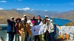
Sacred Lake Wandering: Lake View Experiences at Different Altitudes
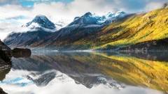
Shannan’s sacred lake scenic spots are the core highlights of tourism. Yamdrok Lake, Pumoyong Lake, and Lhamo La-tso are the most representative. The three lakes have large altitude differences, and the corresponding landscapes and travel suggestions are as follows:
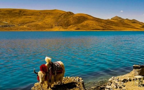
- Yamdrok Lake: Lake surface 4,441m, lakeside highway ~4,500m, one of Tibet’s three sacred lakes with dreamy blue water; Best Travel: Self-drive/charter along the lake, visit viewing platforms slowly
- Pumoyong Lake: Nagarze County, 5,010m, world’s highest freshwater lake, winter blue ice; Travel Tips: Control stay time, carry portable oxygen for emergency
- Lhamo La-tso: 5,300m, Tibetan Buddhist sacred lake for past/present lives; Travel: 3km hike to viewing platform, high physical demand; group travel with local guide recommended
- Transfer Accommodation: Nagarze County (4,470m) for Yamdrok/Pumoyong; Precaution: Low night temperature, keep warm
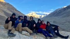
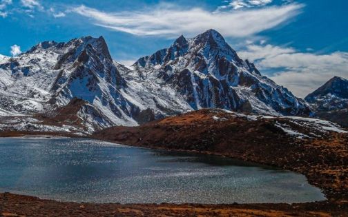
Snow-Capped Mountain Hiking: In-Depth Exploration at High Altitudes
For tourists who love outdoor hiking, the Mount Kuragangri snow-capped mountain hiking route in Shannan is a classic experience. This area generally has a high altitude and belongs to the category of in-depth travel. The core altitude information is as follows:
- Altitude of Core Scenic Spots: The main peak of Mount Kuragangri is 7,554 meters above sea level, and the altitude of surrounding lakes such as Jiujiu Lake, Baima Lin Lake, and Zhegong Three Lakes are all above 4,500 meters
- Hiking Difficulty Altitude: The highest altitude of the Zhegong Three Lakes hiking route reaches 5,200 meters, which has extremely high requirements for tourists’ physical quality and high-altitude acclimatization ability
Corresponding Hiking Preparation and Precautions:
- Acclimatization Preparation: First acclimatize in low-altitude areas for 3-4 days, then gradually go to high-altitude hiking spots
- Hiking Principles: Follow the principles of walking slowly, drinking more water, and moving less. Replenish warm water at any time and avoid strenuous exercise
- Equipment and Weather: Carry windproof and waterproof jackets, warm down jackets and other equipment. Understand the weather forecast in advance, plan the itinerary time, and avoid hiking in bad weather
- Transfer Accommodation: Cuomei County (altitude 4,130 meters) and Lhoka County (altitude 3,865 meters) can be used as transfer accommodation places. The counties have basic accommodation and catering facilities to provide rest guarantee
Lhobuk Valley: An Ecological Journey in a Low-Altitude Secret Land
Lhobuk Valley is an ideal choice for tourists who are worried about high-altitude acclimatization. Its altitude advantages and landscape characteristics are as follows:
- Altitude Data: Located at the southern foot of the Himalayas, with an altitude of only about 2,800 meters, it is a comfortable altitude area in Shannan Tibet
- Landscape & Experience: Primitive forest, humid climate, dense vegetation (distinct from Shannan’s high-altitude areas); experience Monba customs, waterfalls, azaleas; ideal for summer vacation and plateau acclimatization
- Altitude Connection: Cona County (4,350m) has large altitude difference with Lhobuk Valley; stay 1-2 days in Lhobuk for acclimatization before visiting Cona
- Itinerary Preparation: A border pass is required to go to Lhobuk Valley. It is recommended to apply for it in advance at the public security bureau of the household registration place or in Lhasa to avoid delaying the itinerary
Lhobuk Valley
Responding to Altitude Sickness: Make Full Preparations According to Altitude
Altitude sickness is a key concern for Shannan tourists. Scientific prevention and response can ease discomfort. Detailed suggestions follow in three areas: pre-trip preparation, post-arrival acclimatization and emergency treatment.
Pre-Trip Preparation: Basic Steps for Preventing Altitude Sickness
Core preparation points 1-2 weeks before the trip:
- Medication Prevention: You can start taking drugs such as Rhodiola rosea to prevent altitude sickness. Continuous taking is effective, and taking it after departure has limited effect
- Physical Condition Adjustment: Ensure adequate sleep, avoid overwork and colds; Entering high-altitude areas with a cold is likely to cause severe altitude sickness, so you need to wait until your body is fully recovered before traveling
Necessary Equipment List:
- Emergency Oxygen Supply: Portable oxygen tank (it is recommended for each person to prepare 2-3 regular products of 1000-2000ml)
- Sunscreen Products: Sunglasses, hats, sunscreen, etc. (ultraviolet rays are extremely strong in high-altitude areas)
- Warm Clothing: Quick-drying underwear, fleece jackets, thick down jackets, etc. (to cope with the severe temperature difference on the plateau)
- Emergency Drugs: Gaoyuan’an (relieves altitude sickness symptoms), Ibuprofen (relieves headaches), glucose oral liquid (supplements energy)
Acclimatization After Arrival: Gradually Respond to Altitude
The first 24 hours after arriving in Shannan is a critical period for acclimatizing to the plateau. Core precautions:
- Avoid Strenuous Exercise: Such as running, climbing stairs quickly, etc. Move as slowly as possible to give the body enough time to acclimatize
- Dietary Principles: Choose light and easy-to-digest food (such as Tibetan noodles, porridge, etc.), avoid overeating and drinking alcohol (drinking will increase the burden on the body and increase the risk of altitude sickness)
- Water Replenishment: Drink 2-3 liters of warm water every day, sipping small amounts multiple times to help maintain water and electrolyte balance
- Sleep and Ventilation: Open windows properly for ventilation during sleep to keep the indoor air circulating; If the hotel has oxygen supply equipment, it can be used appropriately
- Altitude Acclimatization Rhythm: First stay in low-altitude areas for 1-2 days (such as Tsetang Town), then go to high-altitude scenic spots such as Yamdrok Lake and Lhamo La-tso to gradually increase the acclimatization altitude
Emergency Treatment: Scientific Response to Altitude Sickness Discomfort
Response methods for mild altitude sickness symptoms (headache, dizziness, fatigue, etc.):
- Immediate Treatment: Stop activities immediately, sit down or lie down to rest
- Medication and Supplementation: Take emergency drugs such as Gaoyuan’an, and at the same time replenish warm water and glucose oral liquid. Generally, the symptoms will gradually relieve
- Oxygen Inhalation Suggestion: When symptoms are mild, you can inhale oxygen appropriately to relieve them, but avoid excessive dependence on oxygen, otherwise it will reduce the body’s acclimatization ability
Response methods for severe altitude sickness symptoms (persistent severe headache, vomiting, difficulty breathing, confusion, etc.):
- Core Measures: Stop the itinerary immediately, descend to a low-altitude area, and seek medical treatment in time (oxygen inhalation alone cannot solve the problem, and transferring to a low-altitude area is the most effective measure)
- Pre-preparation: Understand the medical resources along the itinerary in advance (such as the location of county hospitals), and save emergency rescue calls for help in emergency situations
Itinerary Planning: Smooth Travel Routes Adapting to Altitude
Reasonable itinerary planning can effectively improve the travel experience and avoid discomfort caused by rapid altitude changes. The following are two itinerary routes suitable for tourists with different needs, both scientifically planned combining the altitude characteristics of Shannan Tibet.
Classic 5-Day 4-Night: Culture Spots Sacred Lake Tour Route
Detailed Daily Itinerary (including altitude and core arrangements):
- Day 1: Lhasa → Tsetang Town (altitude 3,560 meters); Core Arrangement: Rest and acclimatize after arrival, stay in Tsetang Town at night
- Day 2: Tsetang Town → Yongbulakang Palace (altitude 3,800 meters) → Samye Monastery (altitude 3,570 meters); Core Arrangement: The whole day’s itinerary is relatively relaxed. Visit cultural scenic spots in a shallow way, continue to acclimatize to the altitude, and stay in Tsetang Town at night
- Day 3: Tsetang Town → Yamdrok Lake (altitude 4,441 meters) → Nagarze County (altitude 4,470 meters); Core Arrangement: Appreciate the sacred lake landscape, stay in Nagarze County at night to acclimatize to the higher altitude
- Day 4: Nagarze County → Pumoyong Lake (altitude 5,010 meters) → Lhoka County (altitude 3,865 meters); Core Arrangement: Visit the blue ice landscape (in winter), then go to Lhoka County (altitude drops back for easy rest), stay in Lhoka County at night
- Day 5: Lhoka County → Lhasa; Core Arrangement: End the trip and return
The altitude of this route gradually increases, starting from Tsetang Town at 3,560 meters, gradually transitioning to Yamdrok Lake at 4,441 meters, and finally reaching Pumoyong Lake at 5,010 meters, giving the body enough time to acclimatize. At the same time, it covers the core cultural and sacred lake scenic spots in Shannan, suitable for tourists visiting Shannan for the first time.
In-Depth 7-Day 6-Night: Hiking Spots Ecological Exploration Route
Detailed Daily Itinerary (including altitude and core arrangements):
- Day 1: Lhasa → Tsetang Town (altitude 3,560 meters); Core Arrangement: Rest and acclimatize after arrival, stay in Tsetang Town at night
- Day 2: Tsetang Town → Samye Monastery (altitude 3,570 meters) → Qingpu Meditation Retreat (altitude 4,300 meters); Core Arrangement: Visit cultural scenic spots + initially experience medium and high altitudes, stay in Tsetang Town at night
- Day 3: Tsetang Town → Cuomei County (altitude 4,130 meters); Core Arrangement: Visit Zhegu Grassland (altitude 4,500 meters) on the way, stay in Cuomei County at night to acclimatize
- Day 4: Cuomei County → Guru La-tso Hiking (altitude 4,800 meters) → Cuomei County; Core Arrangement: Shallow hiking experience, stay in Cuomei County at night to rest
- Day 5: Cuomei County → Kagyu Monastery (altitude 4,019 meters) → Lhoka County (altitude 3,865 meters); Core Arrangement: Visit religious scenic spots + altitude transition, stay in Lhoka County at night
- Day 6: Lhoka County → Mount Kuragangri Baima Lin Lake Hiking (altitude 4,700 meters) → Lhoka County; Core Arrangement: In-depth snow-capped mountain and lake hiking, stay in Lhoka County at night
- Day 7: Lhoka County → Lhasa; Core Arrangement: End the trip and return
This route covers Shannan’s classic hiking spots. With complex altitude changes, staying in Cuomei/Lhoka reduces altitude sickness risk. It offers diverse landscapes (snow-capped mountains, lakes, grasslands), suitable for tourists with outdoor experience and high-altitude acclimatization ability.
Travel Supplement: Precautions Beyond Altitude
In addition to altitude sickness prevention and itinerary planning, the following key precautions need to be focused on:
- Border Pass Application: Some areas in Shannan (such as Cona County, Lhoka County, etc.) are border areas, and a border pass is required in advance; Application Channels: Public security bureau of the household registration place, or agency through a travel agency in Lhasa; Required Materials: Original ID card
- Transportation: Some scenic spot roads are rugged (such as Mount Kuragangri hiking route, Guru La-tso, etc.); Suggestions: Choose an off-road vehicle for travel and hire a local experienced driver (familiar with the terrain and altitude changes, and can better cope with various situations on the way)
- Climate Response: Shannan has a plateau temperate semi-arid monsoon climate, with distinct dry and wet seasons throughout the year, strong solar radiation, and large daily temperature difference; Summer: The night temperature may drop below 0℃, so it is necessary to keep warm; Winter: Cold, dry and windy, need to carry thick warm clothing
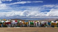
- Respect for Customs: Shannan is the birthplace of Tibetan culture with a strong religious atmosphere; Core Guidelines: Turn the prayer wheels clockwise, do not take photos or point randomly in the monastery, and do not watch or take photos of pilgrims prostrating themselves
In short, altitude is key for Shannan travel. Full preparation and scientific itinerary planning can mitigate altitude sickness risks, letting you fully experience this sacred land’s charm. Whether in low-altitude Lhobuk Valley or high-altitude hiking, Shannan offers diverse experiences. This altitude-focused guide helps ensure a smooth trip.