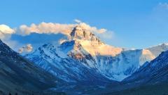
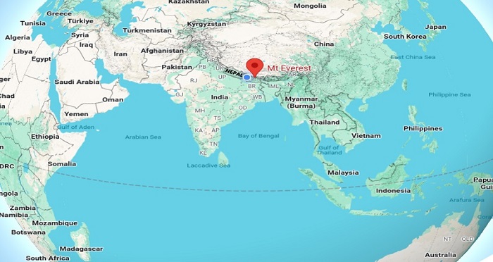
Mount Everest – known as Sagarmāthā in Nepal and Qomolangma in Tibet—stands as the world’s highest peak, piercing the sky at 8,848.86 meters above sea level. For centuries, this colossal mountain has held both explorers’ imaginations and pilgrims’ reverence. But where exactly does Mount Everest sit on the map of Asia? This comprehensive guide dives into the mountain’s precise geographical location, its position on the China–Nepal border, the contrasting approaches from both sides, its place within the broader Himalayan system, and practical travel advice for reaching its legendary base camps.
1. Mount Everest on the Map of Asia
The Himalayas form the towering backbone of Asia, arcing some 2,400 kilometers from Pakistan in the west, through northern India and Nepal, and skirting Bhutan before dipping into southeast Tibet in the People’s Republic of China. Among the dozens of eight-thousanders (peaks above 8,000 meters), Mount Everest reigns supreme at 8,848.86 meters.
- Continental Context
Situated in Central East Asia, the Everest massif straddles the collision zone where the Indian Plate thrusts northward into the Eurasian Plate. This tectonic drama has uplifted the Himalayan range, creating not only Everest but dozens of other giant peaks. - Exact Coordinates
Mount Everest’s summit lies at approximately 27°59′17″ N latitude and 86°55′31″ E longitude, placing it squarely on the China–Nepal border. - Regional Significance
By occupying this strategic ridge, Everest forms part of the natural frontier between Tibetan plateau to the north (average elevation ~4,500 m) and Nepal’s Khumbu region to the south (with deep glacial valleys plunging below 5,000 m).
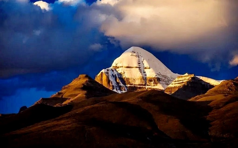
Mount Everest on the Map of Asia
2. Nepal or China: Which Country “Owns” Everest?
Contrary to popular belief, Mount Everest is shared equally by two sovereign nations:
- Border Definition
The international boundary between China (Tibet Autonomous Region) and Nepal intersects the very peak of Everest. Thus, one half of the summit falls within Tibet, the other half within Nepal. - Joint Management
In recent years, mountaineering authorities in both countries cooperated to carry out joint surveys, reaffirming Everest’s height at 8,848.86 m. This collaboration extends to rescue protocols and environmental protection initiatives on both sides. - Cultural Links
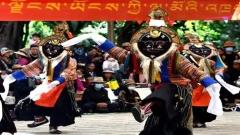
Sherpa communities in Nepal’s Khumbu region and Tibetan villages in Shigatse Prefecture share deep cultural, religious, and familial ties. Sherpa climbers and Tibetan yak herders alike revere Everest as holy ground, weaving its sacredness into their daily lives.
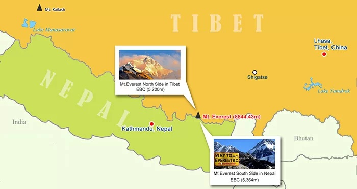
Mt. Everest Nepal Tibet Map
3. The North Face: Everest in China
For those seeking a less crowded vantage point of Everest, China’s northern slope offers unparalleled panoramas:
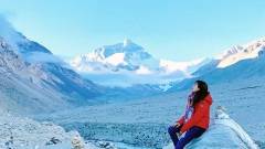
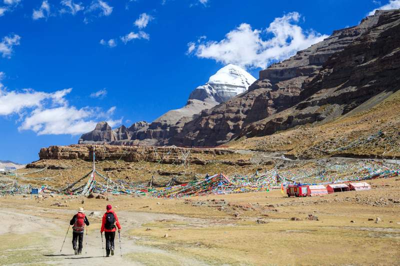
3.1 North Base Camp, Tibet
- Accessibility
Unlike Nepal’s South Base Camp (reachable only by trekking), Tibet boasts a motorable road right to the North Base Camp’s tourist facility at around 5,200 m elevation. This makes it feasible for ordinary travelers to witness Everest’s grandeur without weeks of trekking. - Scenic Highlights
From North Base Camp, you can admire both the imposing north face (a vertical wall rising over 3,500 m) and, on clear days, catch glimpses of the southern slopes stretching toward Nepal.
3.2 Overland Route: Lhasa to Everest
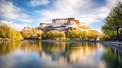
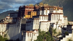
- Lhasa (3,650 m): Acclimatization and cultural immersion—visit Potala Palace, Jokhang Temple
- Gyantse (3,950 m): Explore the ancient Kumbum stupa
- Shigatse (3,900 m): Tashilhunpo Monastery, seat of the Panchen Lama
- Lhatse (4,350 m): Gateway to Everest, with panoramic views of the plateau
- Old Tingri (4,300 m): Final staging town before base camp
- North Base Camp (5,200 m): Arrival and Everest viewing
7–8. Return via Shigatse to Lhasa, with stops to enjoy local Tibetan culture
Best Time to Travel
Late spring (April–May) and early autumn (September–October) strike the ideal balance between stable weather and clear skies. Winter roads may close due to heavy snow, while summer monsoons can bring afternoon storms.
Mt. Everest
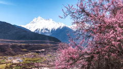
4. The South Face: Everest in Nepal
Nepal’s southern approach to Everest offers a classic trekking adventure:
4.1 South Base Camp & Kala Patthar
- Trek Profile
Starting from Lukla (2,860 m) after a short flight from Kathmandu, trekkers ascend through Namche Bazaar, Tengboche, Dingboche, and Gorak Shep to reach South Base Camp (5,364 m). Kala Patthar (5,550 m) sits 1 km east of camp and provides the best close-up view of Everest’s south face. - Visibility
Unlike the north side, the summit itself cannot be seen directly from South Base Camp. Dawn hikes to Kala Patthar reward early risers with stunning panoramas of Everest, Nuptse, Lhotse, and Changtse.
4.2 Trekking vs. Guided Tours
- Independent Travel
Experienced trekkers can plan logistics, hire porters, and camp independently. - Group Expeditions
For most travelers, joining a guided tour ensures safety, support with permits, and local expertise. Costs for guides and equipment can be shared among group members, making logistics smoother.
5. Everest in the Greater Himalayas: Mahalangur Himal
Mount Everest sits within a specific subsection of the Himalayas called the Mahalangur Himal:
Geographical Bounds
The Mahalangur Himal straddles northeast Nepal and south-central Tibet, encompassing all of the world’s 8,000 m peaks that lie on this stretch of the Himalayan arc.
Neighboring Giants
From the Tibetan vantage point at Gawula Pass (5,230 m), one can view five eight-thousanders lined up from west to east:
- Makalu (8,463 m): Entirely in Nepal, known for its sharp ridges and pyramid shape.
- Lhotse (8,511 m): Fourth-highest; shares much of its route with Everest’s South Col.
- Everest (8,848.86 m): King of mountains, marks the China–Nepal border.
- Cho Oyu (8,201 m): Sixth-highest; considered the most accessible eight-thousander.
- Shishapangma (8,027 m): Entirely within Tibet; often passed en route overland between Lhasa and Kathmandu.
Panoramic Splendor
This compact cluster of colossal peaks makes the Mahalangur Himal one of the most dramatic and picturesque sections of the entire Himalayan range.
6. Approaches from Other Himalayan Countries
While Nepal and Tibet are Everest’s immediate neighbors, other Himalayan nations offer connecting routes:
- India
Major transportation hubs in northern India (Delhi, Kolkata) provide flights to Kathmandu. Overland travel through Sikkim delivers access to nearby peaks but not directly to Everest. - Bhutan
Though Bhutan shares the Greater Himalayas, its rugged topography and strict tourism policies make direct Everest travel impractical. Instead, Bhutan links with Nepalese tours for Himalayan trekking circuits. - Pakistan
Pakistan’s Himalayas lie further west and focus on Nanga Parbat and K2. To visit Everest, travelers usually transit through Indian or Nepalese airports.
7. How to get to Mount Everest?
7.1 Flying Into Nepal and Tibet
- Kathmandu (Tribhuvan International Airport)
The principal gateway for South Base Camp treks. Well-connected to major Asian and Middle Eastern cities. - Lhasa (Gonggar Airport)
Receives flights from Kathmandu, Chengdu, Beijing, and other Chinese cities. Elevation screening and special Tibet permits apply.
7.2 Overland Options
- Kathmandu to Lhasa Highway
A 1,200 km scenic road winding over dramatic mountain passes (Gyirong, Friendship Highway). Typically takes 3–4 days with overnight stops. - Tour Inclusions
Packages often bundle airport transfers, permits (Tibet Travel Permit), guided treks, meals, accommodations, and acclimatization days.
Conclusion & China Dragon Travel’s Expertise
Whether you stand on its motorable northern approach in Tibet or trek the storied trails to Nepal’s South Base Camp, Everest promises an unforgettable encounter with nature’s ultimate heights.
As seasoned specialists in Himalayan journeys, China Dragon Travel offers tailored itineraries, certified guides, and seamless logistics to both sides of Mount Everest. Our expert team ensures your adventure is safe, authentic, and deeply rewarding. Let China Dragon Travel guide you to Mount Everest.