
If you could only choose one road trip in Xinjiang, the Duku Highway would be at the top of the list. Stretching 561 km from Dushanzi in the north to Kuqa in the south, it crosses the Tianshan Mountains and packs deserts, snow peaks, grasslands, and canyons into a single journey—often described as “experiencing four seasons in one day.”
But this is not just a scenic drive. Weather, road conditions, and restrictions can all affect your trip. This guide breaks everything down—routes, timing, must-see spots, and real driving tips—so you can plan it properly and avoid common mistakes.
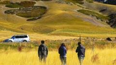
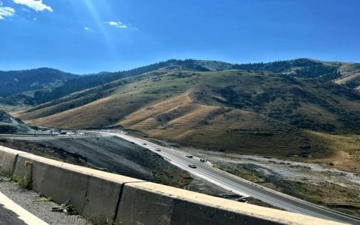
Duku Highway
1. Essential Information (Read Before You Go)
Opening Season
- Typically open from early June to early October (varies yearly)
- Daily access: 08:00–22:00 (closed outside these hours)
- Temporary closures may occur due to landslides or bad weather
Route Overview
- Start: Dushanzi
- End: Kuqa
- Total length: ~561 km
- Highest elevation: ~3,400 m (Hashilegen Pass)
Vehicle Restrictions
- Only vehicles with 7 seats or fewer allowed
- Trailers not permitted
- Some height restrictions apply in certain sections
Tolls
- Mostly free
- Small toll (~RMB 20) near Kuqa
2. Three Sections of the Duku Highway (Completely Different Scenery)
1️⃣ Northern Section: Dushanzi → Jorma (~5 hours)
Keywords: Desert, snow mountains, dramatic roads
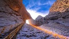
- Dushanzi Grand Canyon: surreal terrain, great for drone shots
- Hashilegen Pass: snow even in summer
- Jorma Martyrs Memorial: tribute to road builders
👉 Features:
Starts with vast desert landscapes, then transitions into snow mountains and alpine scenery.
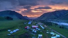
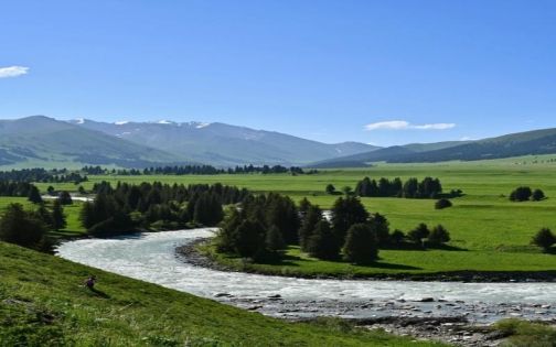
2️⃣ Central Section: Jorma → Bayinbuluke (~1–2 hours)
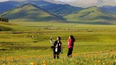
Keywords: Grasslands, wetlands, rivers
- Nalati Grassland: ideal for deeper exploration or overnight stay
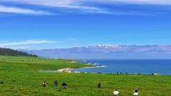
- Bayinbuluke Grassland: famous “Nine Bends and Eighteen Turns” sunset
👉 Features:
Gentler scenery, perfect for slowing down and enjoying nature.
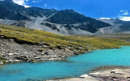
3️⃣ Southern Section: Bayinbuluke → Kuqa (~6 hours)
Keywords: Canyon, Yadan landforms, desert landscapes
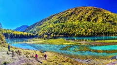
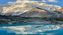
- Large & Small Dragon Pools: alpine lakes under snow peaks
- Tianshan Grand Canyon: dramatic red rock formations
- Yadan landforms: wind-sculpted desert terrain
👉 Features:
A dramatic shift from green grasslands to arid southern Xinjiang landscapes.
3. Classic Northern Route (From Kuytun)
Route: Kuytun → Northern Duku → Jorma → Tangbula Scenic Corridor
What to expect:
- Start early (before 9 AM recommended)
- Moderate traffic, especially oncoming vehicles
- Plenty of roadside stops for photos, restrooms, and snacks
👉 Scenery changes:
- Early: vast desert views
- High altitude: snow mountains + cooler temperatures
- Later: rolling grasslands
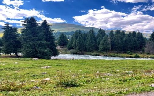
Tangbula Scenic Corridor
- Combination of grasslands, forests, and rivers
- Great for horseback riding and photography
Duku Highway
4. Recommended 3-Day Itinerary (Reverse Route to Avoid Traffic)
Best direction: Kuqa → Dushanzi
Day 1
Kuqa → Tianshan Grand Canyon → Bayinbuluke
- Visit canyon in the afternoon (best lighting)
- Stay overnight in grassland (stargazing)
Day 2
Bayinbuluke → Tangbula → Jorma
- Morning grassland views
- Afternoon horseback riding in Tangbula
- Overnight in Jorma
Day 3
Jorma → Hashilegen Pass → Dushanzi
- Cross snow mountains
- Visit Dushanzi Grand Canyon
👉 Advantages:
- Fewer cars
- Better lighting for photography
- More relaxed pacing
5. Driving Tips & Safety (Very Important)
Before Departure
- Check tires, brakes, lights
- Clean windshield (bugs are common)
- Fill up fuel completely
Road Conditions
- Two-lane road throughout
- Sharp turns and elevation changes
- Speed limits: 40–60 km/h (with speed cameras)
Overtaking Rules
- Broken yellow line: overtake only when safe
- Solid yellow line: never overtake
👉 Rule of thumb: Arriving safely matters more than speed
6. Supplies & Survival Tips
Must-bring items
- Plenty of water
- Instant food (noodles, self-heating meals)
- Energy drinks
- Cash (some areas have no signal)
👉 Why:
- Possible road closures
- Limited food supply points
Restrooms
- More frequent in the north
- Fewer in central and southern sections
Duku Highway
7. Clothing & Gear
Clothing
- Windproof jacket + light down jacket
- T-shirts for lower elevations
👉 Reality:
Temperature differences can exceed 20°C in one day
Other essentials
- Sunscreen (strong UV)
- Sunglasses
- Offline maps
- Drone (avoid restricted areas)
8. FAQs
1. Will I get altitude sickness?
- Highest point is ~3,400 m, usually no issue for most people
2. Is there mobile signal?
- Mostly no signal along the route
3. Can I use a drone?
- Yes in parking areas, but not near checkpoints
4. Are EVs suitable?
- Possible, but plan charging points carefully
5. Is weekend travel recommended?
- No, traffic can be heavy
6. How many days do I need?
- 2–3 days recommended
Duku Highway
9. Final Thoughts
The Duku Highway is only open about four months a year. Weather can change quickly, and every trip is slightly different.
But that’s exactly what makes it special.
From desert to snow peaks, from grasslands to canyons—this is not just a road, it’s a journey through the most diverse landscapes of Xinjiang. No photo can fully capture it. You have to drive it yourself to understand.
recommend route:
North Xinjiang 12-Day Small Group Tour | Urumqi, Kanas, Sayram Lake & Duku Highway