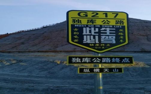
2026 Duku Highway Opening Time & Complete Driving Guide
The Duku Highway is often called the road you must drive once in your lifetime.
Stretching 561 km across the Tianshan Mountains, it connects Dushanzi in the north with Kuqa in the south. Snow peaks, grasslands, canyons, forests, and deserts unfold in a single day.
Half breathtaking scenery, half serious challenge.
If you want to enjoy it safely, read this carefully.
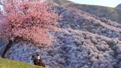
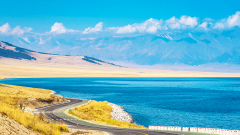
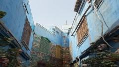
Duku Highway
1. 2026 Opening Date & Core Access Rules
📅 Expected 2026 Opening Period
Based on previous years, the highway is expected to open around mid-June 2026 and close around October 10–mid October, depending on snowfall and road safety conditions.
Historical Opening Periods
-
2016: June 14 – Oct 12
-
2017: May 30 – Oct 9
-
2018: June 21 – Oct 17
-
2019: June 5 – Oct 22
-
2020: June 13 – Oct 12
-
2021: July 4 – Oct 3 (heavy snow year)
-
2022: June 10 – Oct 4
-
2023: June 18 – Oct 10
👉 Conclusion: The road is accessible for only about 4 months each year.
⏰ Driving Hours
-
Generally: 9:00–20:00
-
Peak season (July–August): may start at 8:00
-
Closed at night
-
Peak season traffic control: about 800 vehicles per hour
Even if some sections appear unrestricted, daytime driving is strongly recommended.
🚗 Vehicle Restrictions
-
Only vehicles with 7 seats or fewer are allowed
-
9-seat vans (blue plate), trucks, hazardous cargo vehicles are prohibited
-
RV height limit: 4.5 meters (no trailers allowed)
For the northern section (Dushanzi–Jormar), SUV or AWD vehicles are strongly recommended.
Sedans should avoid rainy days. Beginner drivers are not advised to attempt the northern section.
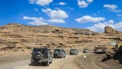
2. Road Sections & Driving Difficulty
Total length: 561 km
Recommended: 2–3 days, not a one-day rush.
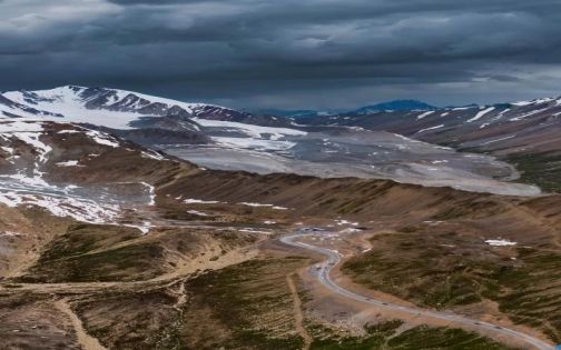
Northern Section
Dushanzi → Jormar: 130 km / ~3.5 hrs
Jormar → Nalati: 100 km / ~2 hrs
Most dramatic scenery and most challenging conditions.
Crosses Haxilegen Pass (elevation 3,400+ m). Snow is possible even in summer.
Middle Section
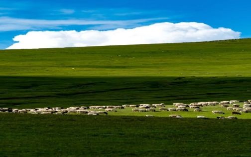
Nalati → Bayinbuluk: 61 km / ~1.5 hrs
Grassland landscapes, smoother road, but strict speed monitoring.
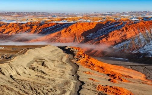
Southern Section
Bayinbuluk → Kuqa: 207 km / ~5 hrs
Canyons and red rock formations. Many curves and low speed limits.
3. Vehicle Preparation Checklist
Before departure, check:
-
Brake pads (≥5mm thickness recommended)
-
Tire tread condition
-
Engine oil and coolant
-
Windshield washer fluid (summer insects are intense)
⛽ Fuel & Charging
Refuel whenever possible. Never let the tank drop below half.
Key fuel stops:
-
Dushanzi
-
Jormar
-
Nalati
-
Bayinbuluk
For EVs:
-
Minimum 500 km real-world range recommended
-
Charging stations are limited and scattered
-
Some fast chargers are available near Nalati and selected service areas
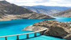
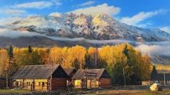
Duku Highway
4. Supplies to Bring
🍞 Food & Water
-
2–3 liters of water per person per day
-
Instant/self-heating meals
-
Beef jerky, chocolate
-
Thermos with hot water
Service areas are basic and may not provide hot water.
💊 Medication
-
Rhodiola (start taking before high altitude exposure)
-
Ibuprofen
-
Stomach medicine
-
Motion sickness pills
-
Band-aids
-
Personal prescription medication
Portable oxygen can be helpful for high passes.
🪪 Required Documents
-
Passport or Chinese ID
-
Driver’s license
-
Vehicle registration
Certain areas near Nalati and Bayinbuluk may require additional checks. ID is often scanned at fuel stations and checkpoints.
5. Critical Driving Safety Rules
-
Honk before blind mountain curves
-
Stay right at all times
-
Use low gear on long downhill sections to prevent brake overheating
-
Slow down in rockfall zones
-
Yield to cyclists and livestock
-
Never drive fatigued
Speed limits:
-
Mostly 40–60 km/h
-
Some areas 30 km/h
-
Maximum rarely exceeds 80 km/h
Full-route speed cameras are active.
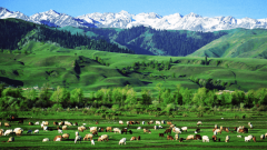
Duku Highway
6. Classic 8-Day Ili Loop (When Duku Is Open)
Day 1 – Arrive in Urumqi
Day 2 – S101 Highway → Dushanzi Grand Canyon → Kuitun/Dushanzi
Day 3 – Sayram Lake → Guozigou Bridge → Liuxing Street → Yining
Day 4 – Yizhao Highway (June–Sept) → Xiata Ancient Trail (view Muzart Glacier) → Tekes
Day 5 – Qiongkushitai Village → Xinyuan
Day 6 – Nalati Sky Grassland → Bayinbuluk Grassland
Day 7 – Drive Duku Highway back to Urumqi
Day 8 – Departure
Sunset at Bayinbuluk’s “Nine Bends Eighteen Turns” is a highlight.
7. If Duku Highway Is Closed
Detour via Hejing or Heshuo to cross between northern and southern Xinjiang. The route is longer but safer during closure season.
8. Accommodation Tips
Book early during peak season (July–August).
-
Dushanzi: standard city hotels
-
Nalati Town: cheaper than staying inside scenic area
-
Bayinbuluk: mainly guesthouses, moderate conditions
Focus on location and availability rather than luxury.
9. Food Recommendations
In Yining:
-
Stir-fried diced meat noodles are reliable
-
Local Uyghur ice cream in Liuxing Street
-
Xinjiang lamb skewers are consistently good everywhere
Avoid eating specialty soups inside highway service areas—local town restaurants are usually better.
Duku Highway
10. Estimated Budget (2 People, 1 Car)
Fuel: RMB 600–800
Accommodation: RMB 200–400 per night
Nalati ticket: ~RMB 95
Bayinbuluk ticket: ~RMB 65
Food: ~RMB 150 per person per day
11. Best Time to Go
-
June: fresh green grasslands, fewer crowds
-
July–August: peak season, possible landslides during rain
-
Mid–late September: fewer tourists, stunning autumn colors
12. Clothing Tips
You may experience four seasons in one day.
Bring:
-
T-shirts
-
Windproof jacket
-
Long pants
-
Scarf
Temperatures at high passes can approach 0°C even in summer.
Bright-colored outfits photograph best against grasslands and snow peaks.
recommend route:
8-Day Northern Xinjiang Tour | Departure from Urumqi to Snowy Mountains & Grasslands