Tucked away on the vast, windswept Tibetan Plateau, the autonomous region of Tibet offers intrepid travelers a rare blend of soaring Himalayan panoramas, deeply rooted spiritual traditions, and unique high-altitude urban centers. Spanning some 1.228 million square kilometers, Tibet is divided administratively into seven prefectures, each anchored by a principal city that reflects the region’s diverse climates, cultures, and landscapes. From Lhasa’s gilded temples to Ngari’s dusty desert vistas, these seven cities together form the backbone of any truly immersive journey through Tibet.
1. Lhasa: The Spiritual Capital and Largest City of Tibet
Lhasa Overview
- Elevation: 3,656 m
- Population: ~868,000
- Climate: Semi-arid highland; mild summers (up to 25 °C), cold winters (down to −10 °C); 3,000+ hours of annual sunshine
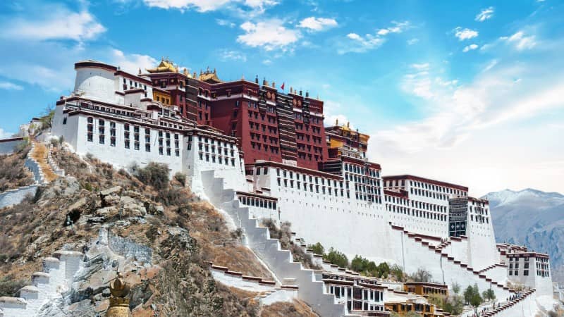
Nestled in the broad, arable Lhasa Valley, the city of Lhasa has been Tibet’s political and religious heart for over 1,300 years. Pilgrims and explorers alike have long flocked to its legendary landmarks: the white-washed Potala Palace, Jokhang Temple, and the bustling Barkhor Barkhor circumference circuit. Lhasa’s high-altitude plain provides just enough oxygen for agriculture, temples, and markets to flourish, creating an otherworldly oasis amid the Himalayan heights.
Lhasa Top Attractions
- Potala Palace: The former winter residence of the Dalai Lamas, with over 1,000 rooms and panoramic city views.
- Jokhang Temple: Tibet’s holiest shrine, attracting devotees on colorful pilgrimage rituals.
- Sera and Drepung Monasteries: Witness the lively monks’ debate sessions and explore centuries-old chapels.
- Norbulingka: The “Jewel Park” summer palace of the Dalai Lamas, with elegant gardens and folk-dance performances.
Best Time to Visit Lhasa & Transport
- Peak Season: April to November—stable weather and clear skies for mountain vistas.
- Transport: Direct flights to Lhasa Gonggar Airport from major Chinese cities (Beijing, Chengdu, Shanghai) and Kathmandu. The high-speed Qinghai–Tibet Railway from Xining delivers travelers straight into the city center.
2. Shigatse (Xigazê): Gateway to Everest and Seat of the Panchen Lama
Shigatse Overview
- Elevation: 3,782 m
- Population: ~798,000
- Climate: Alpine; cold winters, cool summers; strong sunlight year-round
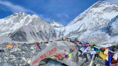
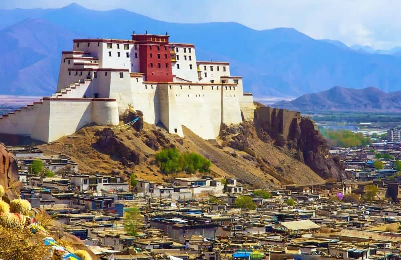
Located about 267 km west of Lhasa along the Friendship Highway, Shigatse is Tibet’s second-largest city. As the traditional seat of the Panchen Lama—the second-ranking figure in Tibetan Buddhism—Shigatse blends institutional monastic life with rugged mountain vistas. It also serves as the primary departure point for overland journeys to Everest’s North Base Camp in neighboring Tingri County.
Shigatse Top Attractions
- Tashilhunpo Monastery: Founded in 1447, this sprawling complex houses the Panchen Lama’s historic seat and impressive tomb chapels.
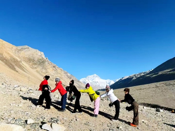
- Everest Viewpoint in Tingri: A two-hour drive from Shigatse brings you to clear views of Everest’s north face, best seen in April–May and September–October.
- Local Markets & Cuisine: Sample hearty tsampa (barley flour), butter tea, and yak-meat specialties in lively town bazaars.
Best Time to Visit Shigatse & Transport
- Peak Season: Spring and autumn, to avoid monsoon clouds and winter snows.
- Transport: Daily flights from Lhasa Gonggar and Chengdu Shuangliu to nearby Chamdo Bamda Airport; however, many travelers prefer the scenic overland drive via the G318 Highway for gradual acclimatization.
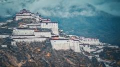
3. Chamdo (Qamdo): Eastern Tibet’s Alpine Crossroads
Chamdo Overview
- Elevation: 3,334 m (Bamda Airport: 4,334 m)
- Population: ~100,000
- Climate: Continental high plateau; cold winters, warm monsoon summers
Perched at the confluence of the Ngomchu and Za Qu rivers in eastern Tibet, Chamdo (formerly Chamdo Prefecture’s seat) acts as a vital crossroads linking Sichuan and Yunnan with central Tibet. Its modern airport, surrounded by green hills and dramatic river gorges, has opened this once-remote region to cultural tourism and ethnic encounters.
Chamdo Top Attractions
- Jampaling Monastery: A serene 12th-century Buddhist temple offering sweeping views of the Chamdo basin.
- Confluence of Rivers: Scenic picnic spots where two of Tibet’s great rivers meet amid reed-lined banks.
- Local Handicrafts: Traditional Tibetan thangka painting workshops and hand-woven wool textiles.
Best Time to Visit Chamdo & Transport
- Peak Season: April to October, avoiding heavy winter snows.
- Transport: Direct flights from Chengdu and Lhasa to Bamda Airport; alternatively, multi-day overland journeys along the G318 Highway wind through blossoming valleys and glacial basins.
4. Nyingchi (Bayi): Tibet’s Green Haven with “Swiss” Landscapes
Nyingchi Overview & Significance
- Elevation: 3,040 m
- Population: ~239,000 (approx. 60,000 in Bayi District)
- Climate: Subtropical highland; lush forests, abundant rainfall, peach-blossom season
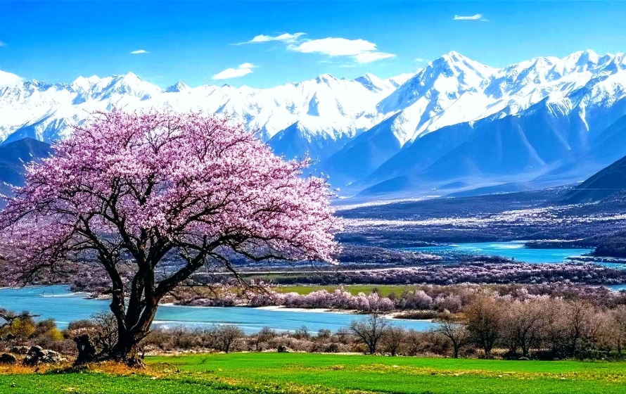
Breaking the stereotype of arid, windswept plateaus, Nyingchi in southeastern Tibet boasts verdant pine forests, pristine lakes, and snow-capped peaks—earning it the moniker “Tibetan Switzerland.” With lower altitudes and abundant rainfall, Nyingchi’s valleys burst into color each spring as peach trees bloom.
Nyingchi Top Attractions
- Bayi Peach Blossom Festival: Late March to mid-April, endless pink blossoms frame local villages.
- Basum Tso Lake: Turquoise waters set against steep cliffs and dense forests.
- Midui Glacier & Lulang Forest: Otherworldly glacial tongues and rhododendron-carpeted woods at 3,700 m.
- Namcha Barwa Viewpoint: Dramatic summit rising over 7,700 m, visible from riverside campsites.
Best Time to Visit Nyingchi & Transport
- Peak Season: March–May for blossoms; September–October for autumn hues.
- Transport: Flights from Chengdu to Nyingchi Mainling Airport or overland via the newly upgraded Sichuan–Tibet Highway, with gentle altitude gain ideal for acclimatization.
5. Shannan (Lhoka/Tsedang): Cradle of Tibetan Civilization
Shannan Overview
- Elevation: 3,700 m
- Population: ~345,000
- Climate: Mild plateau; fertile valleys, steady sunshine
Often overlooked by travelers, Shannan—also called Tsedang or Lhoka—holds Tibet’s earliest chapters. This cradle of civilization saw the rise of King Nyatri Tsenpo in 127 BC and the founding of Tibet’s first palace and monastery.
Shannan Top Attractions
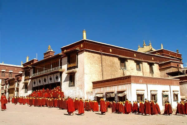
- Yumbulagang Palace: The oldest surviving building in Tibet, perched above the Yarlung River.
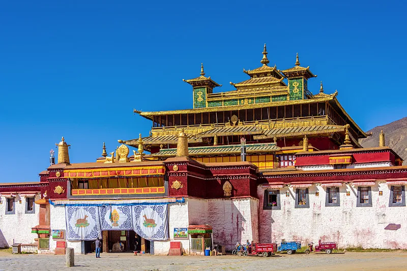
- Samye Monastery: Established in the 8th century as Tibet’s first Buddhist monastery, blending Tibetan, Indian, and Chinese architectural styles.
- Chimpuk Hermitage & Trandruk Monastery: Secluded cliff-side temples offering reflective hiking trails.
- Yarlung Valley Treks: Gentle pathways through farmland and ancient ruins.
Best Time to Visit Shannan & Transport
- Peak Season: May–October for stable weather.
- Transport: A 2-hour drive (122 km) along a well-paved road from Lhasa; private cars, buses, or guided tours.
6. Nagqu (Naqu): The High-Altitude Grasslands
Nagqu Overview
- Elevation: 4,500 m (prefecture average)
- Population: ~359,000
- Climate: Frigid plateau; long winters, short summers; yak pastures
Nagqu claims the title of China’s coldest administrative center, with sweeping yak-grazing grasslands stretching as far as the eye can see. The nearby Qinghai–Tibet Railway brings passengers from Xining and Lhasa, stopping at Nagqu Station (322 km north of Lhasa).
Nagqu Top Attractions
- Horse Racing Festivals: Held each summer, showcasing nomadic traditions and equestrian skill.
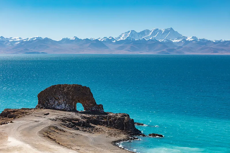
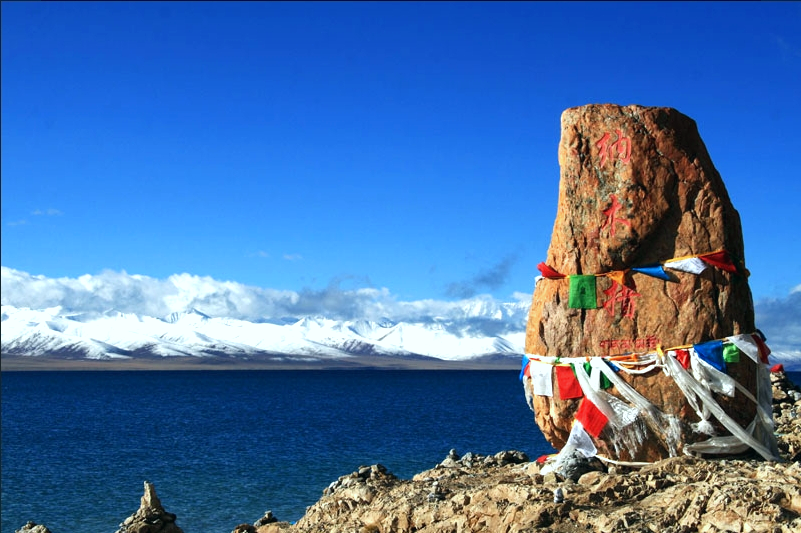
- Namtso Lake: Namtso is a heavenly lake revered by Tibetans and the second largest lake in Tibet.
- Qinghai–Tibet Railway: Engineering marvel traversing permafrost and plateaus.
Best Time to Visit Nagqu & Transport
- Peak Season: June–September, when roads are clear and temperatures briefly rise above freezing.
- Transport: Board the Qinghai–Tibet train from Lhasa or Xining, enjoying panoramic views of the plateau.
7. Ngari (Gar/Shiquanhe): Gateway to Kailash & Western Frontier
Ngari Overview
- Elevation: 4,500 m
- Population: ~123,000 (Gar/Shiquanhe ~17,000)
- Climate: Cold desert; minimal rainfall, intense sunshine (3,500+ hours/year)
In Tibet’s far west lies Ngari Prefecture, one of the planet’s least populated areas. Its capital, Gar—also called Shiquanhe—serves as the staging point for pilgrimages to the sacred Mount Kailash and Lake Manasarovar.
Ngari Top Attractions
- Mount Kailash Kora: A grueling three-day, 52 km circumnavigation pilgrimage revered by Hindu, Buddhist, Jain, and Bon followers.
- Lake Manasarovar: Crystal waters said to cleanse the soul, fringed by snow-draped peaks.
- Guge Kingdom Ruins & Zanda Earth Forest: Echoes of a forgotten kingdom and surreal clay pillars carved by wind and rain.
Best Time to Visit Ngari & Transport
- Peak Season: May–July and September–October, avoiding winter freezes and monsoon washouts.
- Transport: Scenic 1,450 km drive from Lhasa via Yamdrok Lake, Gyirong, and Old Tingri; return flights from Ngari Gunsa Airport.
Explore 7 Largest Major Cities in Tibet
From the gilded halls of Lhasa’s palaces to the rugged deserts of Ngari, Tibet’s seven prefectural centers each offer a unique window into the world’s highest inhabited plateau. Whether you seek spiritual enlightenment, cultural immersion, or heart-pounding alpine vistas, these cities form the foundation of any unforgettable Tibetan odyssey.
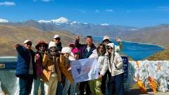
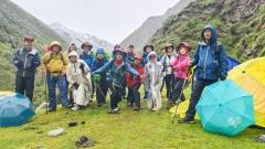
China Dragon Travel specializes in crafting seamless, high-altitude adventures across all seven of Tibet’s urban gateways. Our experienced guides handle every detail—permits, acclimatization, transport, and local insights—so you can focus on the wonder of exploring Tibet’s legendary cities and landscapes. Let us design your next journey to the Roof of the World.