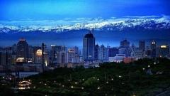
Embarking on a self‑driving adventure through Xinjiang unveils the region’s boundless beauty, from snow‑capped mountain ranges to windswept deserts and vibrant local cultures. Once a key artery of the ancient Silk Road, this land of contrasts has seen centuries of caravans bringing wealth and exchange across Central Asia. Today, modern highways, over twenty airports, high‑speed rails, and intercity trains crisscross Xinjiang, knitting together its far‑flung corners and making a road trip here both thrilling and accessible.
Why Choose a Xinjiang Self‑Driving Tour?
Driving yourself across Xinjiang offers distinct advantages:
- Total Flexibility: Craft your own pace and schedule. Want sunrise at a remote salt lake or an impromptu market visit? Simply pull over.
- Deeper Immersion: Venture off main roads to ancient villages, roadside bazaars, historic caravanserais, and local eateries where flavours reflect centuries of cultural fusion.
- Scenic Freedom: From winding mountain passes to endless desert horizons, you’ll relish uninterrupted views through panoramic windscreen vistas.
- Comfort & Convenience: Modern roads link even the most remote corners. With over 21 airports (centered on Ürümqi Diwopu International) plus high‑speed rail and conventional train lines, you can combine air, rail, and road as you wish.
Recommended Popular Self-Driving Routes in Xinjiang
1. Northern Xinjiang Grand Loop (Approx. 3,900 km, 15 Days)
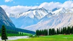
Highlights: Desert edges, alpine lakes, ancient forests, grasslands, canyons, and panoramic Tianshan views.
- Ürümqi to Karamay Desert Edge
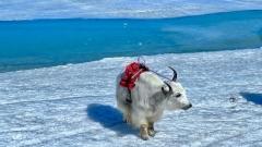
– Depart Ürümqi northward via National Highway G216, skirting the vast Gurbantünggüt Desert. Experience surreal sand dunes meeting a semi‑arid landscape. - Koktokay & Kanas (Altay Prefecture)
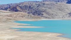
– Head west to the emerald waters of Koktokay, then onward into the Altay mountains. Over two days, explore the turquoise lakes, virgin forests, and nomadic villages around Kanas and Hemu. - Burqin to Aibi Lake & Sayram Lake
– Drive south from Burqin to Aibi Lake’s saline shores before traversing pastoral grasslands en route to Sayram Lake. - Nalati Grasslands & Yining
– Continue west toward the Kazakh‑populated Nalati Grassland, then cross into Ili Prefecture, ending the loop in Yining’s fruit orchards and bazaars. - Duku Highway & Bayinbulak
– Return via the legendary Duku Highway (see Route 3 below), winding through alpine meadows and the famous Bayinbulak Grassland. - Luntai & Hejing back to Ürümqi
– Complete the circle by heading east through Luntai and Hejing, passing vineyards and the Tianshan foothills before arriving in Ürümqi.
Recommended duration: 12–15 days
Ideal season: Late May to early October
2. Southern Xinjiang Grand Loop (Approx. 3,200 km, 10–15 Days)
Highlights: Silk Road oases, desert expanses, ethnic culture, ancient ruins, and spice‑scented bazaars.
- Ürümqi to Kucha & Aksu
– Set off southwest toward the oasis towns of Kucha, famed for its Buddhist grottoes, and Aksu, a hub of Uyghur culture. - Karakoram Highway to Kashgar
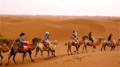
– Optionally detour onto the Karakoram Highway for dramatic mountain scenery before arriving in Kashgar. Don’t miss the Sunday livestock market or the Id Kah Mosque. - Southern Desert Rim (Shache, Yecheng, Hotan)
– Journey along the southern edge of the Taklamakan Desert, stopping at Shache (Yarkand), Yecheng, and Hotan—each town a time capsule of Silk Road history. - Tatank & Ruoqiang
– Travel farther east through Minfeng, then choose between rejoining the northern rim via the desert‑cutting Ruoqiang‑Luntai Highway or continuing east to Qira (Cele). - Return to Korla & Ürümqi
– Head north to Korla—gateway to the Kumtag Desert—then drive back to Ürümqi via the southern flank of the Tianshan.
Recommended duration: 10–15 days
Ideal season: April to November
Insider Tips for Southern Loop
- Fuel & Supplies: Fill up in major towns; desert stretches can be long and remote.
- Local Cuisine: Sample flaky samsa pastries, hand‑pulled noodles, and sweet dried fruits at roadside stalls.
- Permits: Some border‑area roads (e.g., near Karakoram) may require advance paperwork. Consult a travel specialist.
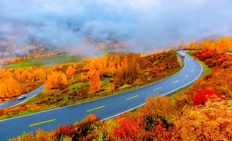
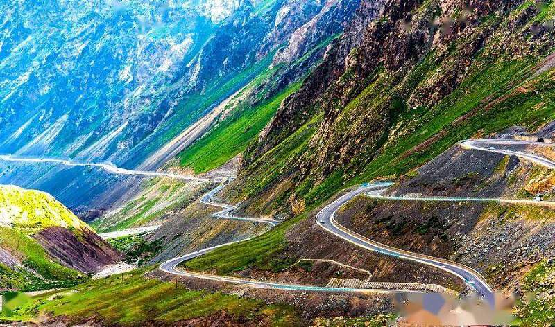
3. Duku Highway (Dushanzi–Kuqa Road, 561 km, 2 Days)
Highlights: Tianshan mountain passes, alpine meadows, red canyons, and panoramic vistas.
- Day 1: Dushanzi → Bayinbulak Grassland
Depart Dushanzi, ascending through dense forests and steep switchbacks. Cross high‑altitude passes blanketed in snow, then descend into the vast Bayinbulak Grassland—an ideal campsite under endless skies. - Day 2: Bayinbulak → Kuqa via Kuerema Grand Canyon
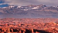
Leave the grasslands and traverse the fiery red walls of the Kuerema Grand Canyon. The road carves through sculpted rock formations before descending into the oasis city of Kuqa.
Open season: Early June to late September
Driving difficulty: Moderate to challenging; road may be narrow and winding.
Preparation: 4×4 vehicle recommended; carry extra water and high‑energy snacks.
Duku Highway
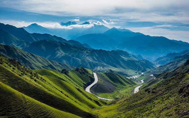
4. Yining–Zhaosu Route (Yizhao Highway, 120 km, 1 Day)
Highlights: High‑altitude pass, wildflower meadows, and panoramic Tianshan valleys.
- Route Overview: This historic Silk Road segment—once part of the “Bow‑Lunar Path”—winds 120 km from Yining to scenic Zhaosu.
- Key Feature: The Anglieteda Pass, perched above 3,000 m, offers sweeping views of snow‑peaked ridges and cascading valleys.
- Extensions: Continue south to Shata scenic area, then loop back via Tekes County to Yining, linking Ili’s top attractions.
Open season: June through September
Driving difficulty: Moderate; narrow mountain roads require cautious driving.
Yizhao Highway
5. Xinjiang–Tibet Highway (New Tibet Line, 1,100 km, 3–5 Days)
Highlights: High‑altitude challenge, remote landscapes, glacial rivers, and the borderlands of China and Tibet.
- Yecheng “Zero Point” → Senga (Shiquanhe)
– Begin at Yecheng’s highway marker, ascending to Kudi‑Daban Pass (over 5,000 m). - Mazhadan Pass → “Death Valley” (Quanshuigou)
– Traverse the otherworldly barren lands nicknamed “Mars Valley,” where oxygen levels plummet. - Jieshan Daban (5,248 m) → Tibet Border
– Cross the final high pass and descend into the Tibetan prefecture, ending at Senga’s airport.
Driving difficulty: Very high—extreme altitude, limited oxygen, and sparse services.
Recommendations:
- Acclimatize for at least 48 hours before departure.
- Travel in convoys and carry medical oxygen.
- Avoid overnight stops above 4,500 m.
Open season: Mid‑May to early October (weather permitting).
Planning Your Xinjiang Self‑Drive Adventure
- Vehicle Selection
– Opt for a comfortable SUV or 4×4 with high ground clearance. Ensure reliable air conditioning and heating. - Accommodation
– Book ahead in major towns. For grasslands and desert camping, consider portable shelters or local yurt stays. - Permits & Documentation
– Border roads and areas near sensitive detection zones may require permits obtained weeks in advance. - Safety Essentials
– GPS navigator, paper maps, spare tyre, toolkit, first‑aid kit, high‑altitude medication, and extra fuel cans. - Local Culture & Etiquette
– Respect local customs—ask before photographing villagers, dress modestly in Uyghur and Kazakh communities, and learn basic greetings in Uyghur or Kazakh.
A self‑driving tour of Xinjiang is more than a journey—it’s an odyssey through time and terrain. From Tianshan’s lofty peaks to the sands of the Taklamakan, each kilometre reveals a new facet of China’s western frontier. Whether you choose the sweeping Northern Loop, the cultural tapestry of the Southern Loop, the epic Duku Highway, the scenic Yizhao Pass, or the daring Xinjiang–Tibet Highway, your road trip will forge memories as vast as the landscapes you traverse. Start planning today, pack your spirit of adventure, and let Xinjiang’s epic highways guide you into the heart of Asia’s storied Silk Road.
![11 Day Tour[Winter Limited] Drunken Beauty Xinjiang Ice and Snow Kanas Fairy Tale New Vision](https://www.chinadragontravel.com/wp-content/uploads/2025/12/25cff76cef9e445-240x135.jpg)