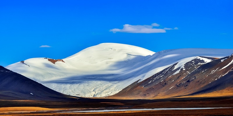
The Kunlun Mountains form one of central Asia’s major mountain systems and are often described as the “ancestor of ten thousand mountains” in Chinese tradition. Geographically the range links the Pamir plateau in the west with high plateaus of Qinghai and the eastern fringes of the Tibetan plateau, extending for many hundreds (even thousands) of kilometres across Xinjiang, Qinghai and Tibet. The chain has varied widths – relatively narrow in the west and much broader to the east – producing a mix of jagged peaks, rolling alpine meadows and highland deserts.
Kunlun Mountains Geology, Peaks, Lakes & Legends
The Kunlun range is more than a scenic backdrop; it is a tectonic record. The mountains formed (in geological terms) along major crustal collisions and faults, and their uplift and erosion have defined much of western China’s terrain. The Kunlun Fault is an active geological feature that has shaped lakes, river courses and local seismicity for millennia, contributing to the dramatic landforms you can see today. The range’s remoteness and harsh climate mean there are surprisingly few roads crossing it, and much of the region remains unmarred by mass tourism.
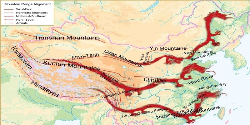
Kunlun Mountains on Map
Kongur Tagh and Neighboring Giants
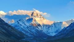
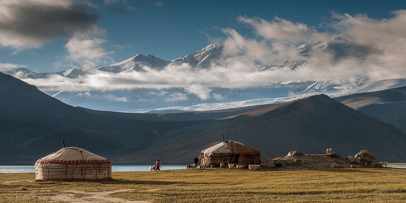
The highest mountains often associated with the Kunlun region sit at the interface with the Pamirs. Peaks like Kongur Tagh (elev. c. 7,649 m) and the nearby Muztag Ata dominate the skyline in western Xinjiang and are visible across shimmering highland lakes. Kongur Tagh, while physically linked to the broader Pamir-Karakoram complex, is one of the most prominent high summits in the area and a dramatic sight from Karakul Lake.
Heihai Lake (The Jade Pond of Legend)
High on the northern edge of the Kunlun fold, Heihai Lake (often linked in legend to the Queen Mother of the West’s “Jade Pond”) sits at around 4,420–4,446 m elevation. This cold, clear alpine lake drains to form the sources of the Kunlun River (upper stretches of the Golmud), and the surrounding meadows and permafrost soils make it a fragile but striking highland ecosystem. If you travel here, respect local rules: these lakes are sensitive and seasonal conditions can change rapidly.
Yuzhu and Yuxu Peaks: Sacred Snow Sisters
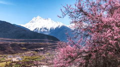
In the eastern Kunlun, peaks such as Yuzhu Peak and Yuxu Peak hold spiritual significance and are perpetually wrapped in snow and mist. These peaks are focal points for pilgrimage and local myth, and they help create the “Kunlun June Snow Wonder,” a phenomenon of late-spring and early-summer snowfields and glaciers that linger even as lower-elevation grasses green.
Kunlun Mountains Legends and Culture
The Kunlun has been a sacred space in Chinese myth and Taoist cosmology for thousands of years. Ancient stories place the Queen Mother of the West — a powerful Taoist deity — on Kunlun’s slopes, presiding over sacred orchards and the legendary “Jade Pond.” Tales speak of heavenly peaches, immortal guests and rivers that do not let a feather float. For travellers, the legends enrich the landscape: a canyon, a lake or a lone snow peak becomes a narrative anchor that local guides will happily explain. Engaging with these stories respectfully deepens the experience, especially when visiting remote shrines, rock paintings or local village sites where oral traditions are still strong.
Kunlun Mountains Top Attractions and Natural Highlights
Heihai Lake and the Kunlun Sources
Heihai Lake’s clear water and high location make it an excellent base for short hikes, photography and witnessing vast flocks of migratory birds when conditions allow. Rock art panels and traces of ancient pastoral life can be found on approach routes, giving a sense of the human timeline in an otherwise wild landscape.
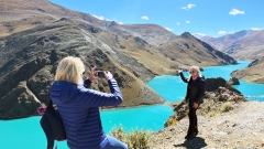
Karakul Lake and the Kongur View
On the Xinjiang side, Karakul Lake is an azure mirror below Kongur Tagh and Muztag Ata. The contrast of black volcanic shorelines, white snow ridges and broad blue skies is cinematic. This area is often combined with travel along the Karakoram Highway and makes for spectacular long-drive photography.
Kunlun Mountain Pass (Kunlun Pass)
Sitting at roughly 4,767 m above sea level, the Kunlun Pass is the historic gateway linking Qinghai and regions to the south toward Tibet. It’s an important stop on the Qinghai–Tibet Highway, offering dramatic views, high-altitude meadows and a real sense of space. The pass area supports unique ecological communities — look for hardy grasses, cushion plants and, with luck, small herds of nomadic yaks or Tibetan antelope in the wider region.
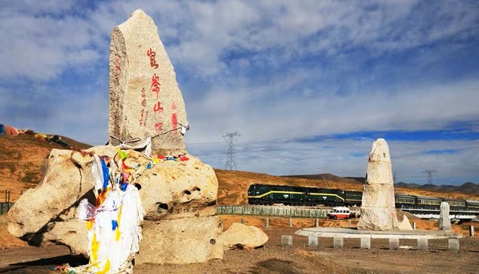
Kunlun Mountain Pass
Kunlun Spring and Ancient Sources
Along several river valleys you’ll find springs and seepage points where meltwater concentrates, forming ice-free springs even in cold seasons. These water sources traditionally carried spiritual importance and today are vital for wildlife and local pastoralists.
Flora, Fauna and Conservation Notes
Although the Kunlun looks forbidding, it supports specialized life: cushion plants, hardy grasses and saline-tolerant shrubs on plateaus, plus migratory birds around lakes. In larger reserves you may glimpse Tibetan antelope, wild yaks and other highland fauna. The region’s permafrost and glacial systems are sensitive to warming; sustainable travel practices help preserve these landscapes.
Best Time to Visit Kunlun Mountains
The Kunlun’s climate is high-altitude continental: long, cold winters and short summers. The most practical travel window runs from late May to early October. Within that period:
- June–August: warmer, wildflowers and accessible passes — high risk of sudden weather shifts.
- September: crisp skies, fewer tourists and dramatic alpine light — a favourite month for photographers.
- Late spring and early summer: snow wonder in higher sections (the “June Snow”) can be spectacular but occasionally blocks roads.
Always check local road and weather reports before travelling; conditions can change suddenly and road access is sometimes seasonal.
Kunlun Mountains
How to Get to Kunlun Mountains: Practical Routes
There are several reasonable approaches depending on where you’re coming from:
- Fly to Xining (Qinghai) or Golmud, then drive: Many travellers fly into Xining or Golmud and continue overland toward the Kunlun Pass or Heihai Lake. From Golmud, Kunlun Pass is roughly 160 km south and typically 3–4 hours by road in good conditions. Private charters and 4×4 hire are common for access to remote areas.
- Overland via Xinjiang (Karakul & Kongur views): If visiting the western fringes, the Karakoram Highway and local roads around Tashkurgan and Karakul Lake provide access to Kongur Tagh views. Expect long driving days and remote stops.
- Organised tours and private charters: Because public transport is limited, many international travellers join small-group or private tours with experienced operators to handle permits, local drivers and altitude planning. China Dragon Travel can help arrange customised Kunlun itineraries, permits and 4×4 transfers for international visitors (see final paragraph).
Note: road conditions, permits and local regulations in highland border regions can change; arrange logistics through experienced travel companies.
Kunlun Mountains Altitude, Safety and Responsible Travel
The Kunlun is high country — many attractions sit above 4,000 m. Manage altitude risk: ascend slowly, stay hydrated, avoid heavy exertion for the first 24–48 hours and carry medication or seek medical advice if you have pre-existing conditions. Weather can flip rapidly: warm layers, windproof shells and good footwear are essential. Satellite communications or a local guide are recommended in remote zones.
Respect fragile ecosystems: camp only in designated spots, avoid littering and keep noise to a minimum. Many areas are used seasonally by herders; ask permission before entering private grazing plots or photographing people and their livestock.
Practical Tips and Packing List
- Documents: Passport, visa (if required), any regional permits — local operators can advise.
- Clothing: Layering system (base layer, insulating mid-layer, windproof/waterproof outer).
- Footwear: Sturdy, broken-in hiking boots with ankle support.
- Health: Altitude meds, sunscreen, sunglasses (strong UV), basic first aid.
- Electronics: Spare batteries and power banks — cold drains batteries fast.
- Cash: Small towns may not accept cards; carry local currency for fuel, food and tips.
- Transport: Book 4×4 transfers for remote routes; local drivers are indispensable.
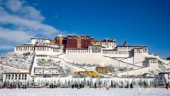
Kunlun Mountains, Tibet, China
Responsible Photography and Cultural Etiquette
The Kunlun Mountains – one of Central Asia’s largest ranges – form the central backbone of western China’s mountainous terrain. Beginning at the Pamir Plateau in the west, the Kunlun connects geographically and geologically to the great Asian ranges such as the Himalayas, the Tianshan Mountains, and the Sulayman Mountain.
When photographing sacred peaks, shrines or local people, ask permission and be mindful of religious items. Avoid stepping on or rearranging ritual offerings, and accept that some sites are off-limits to visitors. Use your photos to tell a respectful story — share local names, legends and the voices of those you meet.