Self-Driving the G314 China–Pakistan Friendship Highway
From Kashgar to the Pamir Plateau — One of the World’s Most Underrated Mountain Roads
Many travelers come to Xinjiang with only one road in mind: the Duku Highway.
But if you truly want to experience what it feels like to drive at the edge of the world, the G314 China–Pakistan Friendship Highway in southern Xinjiang is the real masterpiece.
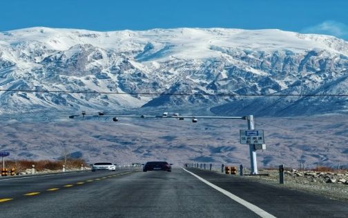
Leaving Kashgar, the familiar greenery of the city fades quickly.
Tall trees, roadside shade, and urban colors gradually disappear.
The landscape begins to transform — from green valleys to vast red丹霞 (Danxia) formations, while snow-capped mountains slowly emerge on the horizon.
As the altitude rises, the temperature drops almost unnoticed.
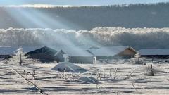
Then, when you step out of the car at Baisha Lake, the cold wind hits instantly — a clear reminder that you have officially entered the Pamir Plateau.
G314 China-Pakistan Friendship Highway
Must-See Landscapes Along G314
🏞️ Baisha Lake
Baisha Lake is located in Bulunkou Township, Akto County, directly beside the G314 highway.
At around 3,300 meters above sea level and roughly 200 km from Kashgar, it is often the first true Pamir landmark for self-drivers.
Across the lake stand vast white sand dunes shaped by centuries of wind erosion.
On the other side rise the towering Kongur snow peaks.
Sand, water, and snow mountains form a scene that feels both powerful and silent.
Practical tips:
-
The scenic area requires a ticket, but parking is free
-
Even without entering the park, you can photograph the lake directly from the roadside
-
Strong wind and low temperatures — bring warm layers
If you plan to stop later at Karakul Lake, you may choose only one of the two to avoid repetition.
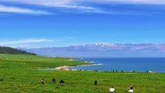
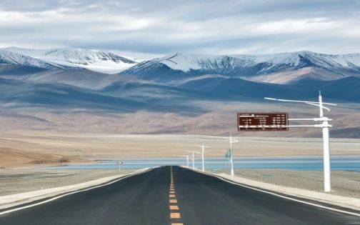
🌿 Tashkurgan Wetland (Tageerman / Taxkorgan Wetland Area)
One of the most precious green landscapes on the Pamir Plateau.
This vast alpine wetland lies beside the G314, surrounded by snow peaks and fed by winding streams.
Grasslands stretch endlessly, dotted with grazing yaks and sheep, creating a rare softness in the high-altitude wilderness.
It is an ideal place to stop, slow down, and simply absorb the scale of the plateau.
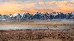
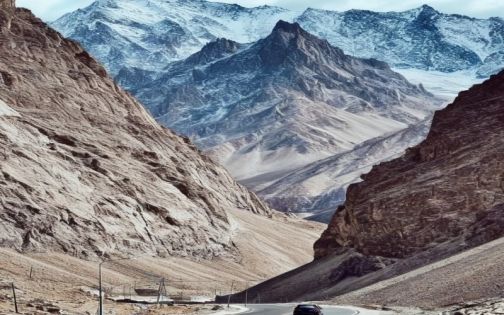
🏔️ Kongur Peak & Muztagh Ata
Snow mountains accompany you for most of the journey along G314.
Kongur Peak appears sharp and dramatic, while Muztagh Ata feels broader and more commanding.
From Baisha Lake to Karakul Lake, from wetlands to random roadside pull-offs, breathtaking mountain views are everywhere.
This is why many travelers say:
On G314, the road itself is the viewpoint.
🏞️ Muztagh Ata Glacier Park (Optional)
Shortly after leaving the wetland area, you’ll see the entrance to Muztagh Ata Glacier Park.
If time allows, it’s worth entering; otherwise, it can easily be saved for another trip.
G314 China-Pakistan Friendship Highway
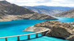
Entering the Heart of the Pamir Plateau
From here on, the journey reaches its most iconic sections:
Panlong Ancient Road, Bandir Blue Lake, Tashkurgan County, and Khunjerab Pass
Border Permit Reminder (Very Important)
Travel from Kashgar to Tashkurgan requires a Border Permit.
Recommended location:
Kashgar Old City Tourist Police Station (near the mosque)
Fewer people, faster processing — usually about 20 minutes.
Do not wait until you reach checkpoints on the road.
Khunjerab Pass — The World’s Highest Border Gate
📍 Tashkurgan County, Kashgar
🏔️ Elevation: approx. 5,100 meters
🎫 Ticket + shuttle bus: around 38.5 RMB
🕑 Open year-round (may close temporarily due to extreme weather)
Important tips:
1️⃣ Buy tickets online in advance (QR code entry)
2️⃣ Arrive before 10:00 or after 15:00 to avoid crowds
3️⃣ Bring oxygen canisters, down jacket, hat, and sunglasses
4️⃣ Extremely strong UV radiation and wind; drones are prohibited
Must-take photos:
-
With the national border gate
-
With Boundary Marker No. 7
-
With the “5100 m” altitude sign
Standing here, watching the snow mountains and national flag together, the meaning of borderland travel becomes deeply tangible.
G314 China-Pakistan Friendship Highway
Why G314 Is a Top-Tier Self-Drive Route
✔ One journey through glaciers, red mountains, wetlands, alpine lakes, and winding roads
✔ Cinematic road views at every turn
✔ Real borderland culture along the China–Pakistan and Central Asia corridors
✔ Open most of the year — unlike the frequently closed Duku Highway
This is not a road to rush through.
It’s a road meant to be driven slowly.
Why Are There So Many Trucks on G314?
Because this highway is:
-
China’s only direct land route to Pakistan
-
A key logistics corridor linking Central and South Asia
-
A vital artery of the Belt and Road Initiative
Those trucks with dual national flags are not tourists — they are the daily pulse of international trade.
Self-Driving Safety Tips
-
Altitude sickness is real — bring oxygen
-
Narrow curves between Oytagh and Baisha Lake — drive cautiously
-
Do not stop in marked avalanche zones
-
Trucks are slow at altitude; overtake only on clear, straight sections
![11 Day Tour[Winter Limited] Drunken Beauty Xinjiang Ice and Snow Kanas Fairy Tale New Vision](https://www.chinadragontravel.com/wp-content/uploads/2025/12/25cff76cef9e445-240x135.jpg)