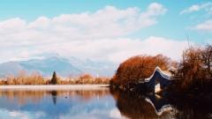
Xishuangbanna is famed for lush rainforests, traditional Dai bamboo houses and fresh tropical fruits, yet its unique altitude distribution shapes its rich and diverse allure. Knowing its altitude helps tourists adapt quickly, plan rational travel routes and savor distinct natural scenery across different altitude zones. It has a huge altitude gap: southern river valleys stand at just hundreds of meters, while northern mountains exceed 2,000 meters, each altitude boasting unique natural views and amazing travel experiences. This detailed altitude guide will ensure a smooth and enjoyable trip to Xishuangbanna.
A Preliminary Look at Yunnan Xishuangbanna Altitude
Located at the southernmost tip of Yunnan Province, Xishuangbanna in Yunnan is on the northern edge of the tropics south of the Tropic of Cancer. Its unique geographical location has created a complex and diverse altitude distribution pattern, showing an overall terrain feature of high in the northwest and low in the southeast. This altitude difference is also one of the core reasons for the diversity of local natural scenery and climate, which has a direct impact on the travel experience of tourists.
Overall Altitude Data of Yunnan Xishuangbanna
According to relevant geographical survey data, the average altitude of the entire Xishuangbanna Prefecture in Yunnan is about 800 meters. This altitude is much lower than other plateau areas in Yunnan, which is extremely friendly to most tourists. There is almost no altitude sickness, making it a tourist destination suitable for travel all year round.
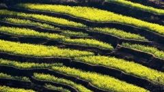
In terms of altitude extremes, the altitude drop in Xishuangbanna is extremely large. The highest point is Huazhuliangzi in Mengsong Township, Menghai County, with an altitude of up to 2429 meters, which is a gathering place for local mountaineering and outdoor adventure enthusiasts. The lowest point is the confluence of the Lancang River and the Nanla River, with an altitude of only 477 meters. Located in the tropical river valley area, it is hot and humid all year round, full of tropical charm. This altitude drop of more than 1900 meters has created a unique vertical landscape zone from tropical river valleys to subtropical mountains, allowing tourists to experience different natural scenery in a short distance.
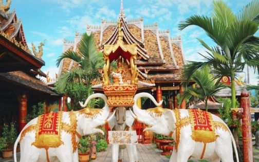
Xishuangbanna Dai Ethnic Park
Correspondence Between Altitude Distribution and Administrative Regions
Xishuangbanna has jurisdiction over three core areas: Jinghong City, Menghai County and Mengla County. The altitude difference in each area is obvious, which directly affects the local climate and travel experience. Tourists can choose the focus of their trip according to their own needs:
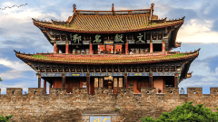
- Jinghong City: As the seat of the Xishuangbanna Prefectural Government, it is the first stop for most tourists. The average altitude of the urban area is 552 meters, with flat terrain and hot and humid climate. The annual average temperature is about 21.8℃, and the daytime temperature in winter can reach more than 25℃, making it the first choice for winter vacation. Most of the scenic spots in the city are in low-altitude areas, suitable for family trips.
- Menghai County: Located in the northwest of Xishuangbanna, it has a relatively high terrain with an average altitude of 1176 meters, making it the highest among the three areas. Affected by the altitude, the climate here is cooler than that of Jinghong City, and the average summer temperature is 3-5℃ lower than that of Jinghong, which is a summer resort for local residents and tourists. It is also the core producing area of Pu’er tea, and most of the ancient tea mountains in the county are located in high-altitude mountains.
- Mengla County: Located in the southeast of Xishuangbanna, bordering Laos and Myanmar, it has a moderate altitude of 640 meters on average, located at the junction of river valleys and mountains. The climate is mild, and there are large areas of primitive tropical rainforests in the county, which is an ideal area for exploring natural ecology. It is also one of the main planting bases for tropical crops in Xishuangbanna.
Detailed Altitude of Popular Scenic Spots
The popular scenic spots in Xishuangbanna are distributed in different altitude zones. The altitude of each scenic spot not only affects the characteristics of the scenery, but also relates to the physical adaptation of tourists. The following is a summary of the most popular scenic spots’ altitudes and travel precautions, covering natural, cultural, leisure and other types, to facilitate everyone’s travel planning.
Low-Altitude Scenic Spots: Comfortable and Easy to Adapt
Most of these scenic spots are below 800 meters above sea level, with flat terrain and hot climate. The scenery is mainly tropical rainforests and Dai culture. There is no need to worry about altitude sickness, which is suitable for tourists of all ages and is the core experience area of Xishuangbanna tourism.
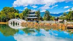
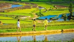
- Manting Park: Located in the urban area of Jinghong City, with an altitude of about 550 meters, basically the same as the average altitude of Jinghong urban area. It is located in a flat dam area. The park has a large number of tropical plants, including ancient and famous trees, rare flowers and plants, as well as the former residence of the Dai royal family and the Total Buddhist Temple. It is a good place to experience Dai culture and tropical garden scenery. The tour difficulty is low, and you can walk around the whole park.
- Xishuangbanna Tropical Botanical Garden, Chinese Academy of Sciences: Located in Menglun Town, Jinghong City, with an altitude of about 570 meters, it is located on a peninsula surrounded by the Luosuo River, a tributary of the Lancang River. It is the largest botanical garden in China with the most types of tropical plants collected. Affected by the low-altitude tropical climate, the garden is covered with dense vegetation, and tropical fruit trees and rainforest vegetation can be seen everywhere. It is necessary to take sun protection and mosquito prevention measures when visiting, and it is recommended to plan half a day to visit carefully.
- Dai Garden: Located in Olive Dam, Jinghong City, with an altitude of about 530 meters, it is a village community focusing on displaying Dai customs. The Dai bamboo houses here are built against the mountains and near the water, complementing the low-altitude flat dams and rice fields. Tourists can experience Dai bamboo house accommodation, taste Dai food, watch Dai song and dance performances, and feel the most real Dai life. There is almost no altitude fluctuation during the tour, and the comfort is extremely high.
- Mengyuan Fairyland: Located in Mengla County, the entrance of the scenic spot is about 570 meters above sea level, and the highest point is about 1250 meters above sea level. The overall altitude of the scenic spot shows a slow upward trend, and the core scenery is karst caves and rainforest canyons. From the entrance to the peak, the types of vegetation along the way will change significantly three times. It is necessary to pay attention to safety underfoot when visiting. Although the altitude change is not large, the cave is wet and slippery, so it is recommended to wear comfortable sports shoes.
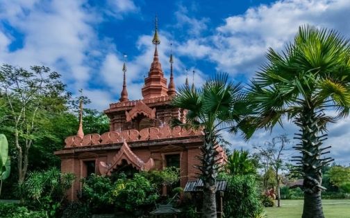
Manting Park
Medium and High-Altitude Scenic Spots: Cool Summer Resort
Most of these scenic spots are between 1000-2000 meters above sea level, mainly distributed in Menghai County and the northern mountains of Jinghong City. The climate is cool, and the scenery is mainly tea mountains, alpine rainforests and ethnic minority villages. It is suitable for tourists who like summer vacation, outdoor adventure and in-depth experience. Some scenic spots have large altitude changes, so it is necessary to make adaptation preparations.
- Nannuo Mountain Ancient Tea Mountain: Located at the junction of Jinghong City and Menghai County, with an altitude of about 1400-1800 meters, it is one of the famous ancient tea mountains in Xishuangbanna and the core producing area of Pu’er tea. It is surrounded by clouds and mist all year round, with towering ancient tea trees. Affected by the medium and high altitude, the climate is cool, making it an excellent place for summer vacation and tea culture experience. When visiting the tea mountain, you need to walk along the mountain road with a certain altitude fluctuation. It is recommended to wear comfortable sports shoes. Some tourists with sensitive constitution may experience slight tinnitus, which is a normal pressure change reaction and can be relieved by proper rest.
- Hekai Ancient Tea Mountain: Located in Menghai County, with an altitude of about 1400-1800 meters, similar to Nannuo Mountain, it is one of the largest ancient tea mountains in Xishuangbanna. The ancient tea tree communities in the county are well preserved, planted against the mountains, and set off with Hani villages. Here you can not only taste freshly picked Pu’er tea, but also experience Hani folk culture. The mountain climate is cool, with an average summer temperature of about 22℃, which is a dual resort for cool summer vacation and tea culture experience.
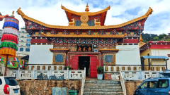
- Jinuo Village: Located in Jinuo Mountain Town, northeast of Jinghong City, with an altitude of about 1100-1300 meters, it is the main settlement of the Jinuo people and the last recognized ethnic minority village in China. The village is built against the mountain, with a slow upward altitude trend. Along the way, you can enjoy alpine rainforest scenery and traditional Jinuo architecture and folk culture. The altitude change during the tour is gentle, suitable for most tourists. The square at the top overlooks the entire village and the surrounding tea mountain scenery.
High-Altitude Scenic Spots: Proceed with Caution
Most of these scenic spots are above 2000 meters above sea level, mainly mountains and peaks, with magnificent scenery. They are suitable for outdoor adventure and mountaineering enthusiasts. Ordinary tourists need to proceed with caution, make preparations for the prevention and response of altitude sickness, and it is recommended to go with partners to avoid going to undeveloped areas alone.
- Huazhuliangzi: Located in Mengsong Township, Menghai County, with an altitude of up to 2429 meters, it is the highest point in Xishuangbanna and a well-known mountaineering resort locally. Located in the alpine area, it is surrounded by clouds and mist all year round. From the top of the mountain, you can overlook the alpine and river valley scenery of Xishuangbanna, and there are primeval forests and wild animals distributed in the mountains. Mountaineering to Huazhuliangzi requires certain outdoor experience. The altitude is high and the temperature is low, so it is necessary to carry warm clothes. During the mountaineering, gradually adapt to the altitude change and avoid strenuous exercise.
- Mengsong Ancient Tea Mountain: Located in Mengsong Township, Menghai County, with an altitude of about 1800-2400 meters, adjacent to Huazhuliangzi, it is a representative of high-altitude ancient tea mountains in Xishuangbanna. Most of the ancient tea trees in the county grow in mountains above 2000 meters above sea level. Affected by high altitude, strong light and large temperature difference, the Pu’er tea here is of excellent quality and rich aroma. Exploring the tea mountain needs to be led by local people. The mountain road is rugged and the altitude changes greatly, so it is necessary to take protective measures and prepare for altitude sickness response.
Travel Essentials: Practical Tips Related to Altitude
The core significance of understanding the altitude of Xishuangbanna in Yunnan is to better plan the trip, adapt to the environment, and make the travel experience more comfortable and safe. The overall altitude of Xishuangbanna is relatively low, and most tourists can adapt easily, but the climate and environment of different altitude zones are quite different. The following tips and precautions must be collected by tourists.
The Relationship Between Altitude and Climate: Dressing Suggestions
According to the monitoring data of the Institute of Atmospheric Physics, Chinese Academy of Sciences, for every 100 meters increase in altitude in Xishuangbanna, Yunnan, the annual average temperature drops by about 0.6℃. This climate gradient directly affects tourists’ choice of clothing and equipment. The equipment suggestions for different altitude zones are as follows, which can be adjusted according to your own itinerary:
- Low-Altitude Areas: Below 800 meters above sea level, including Jinghong urban area, Dai Garden, Tropical Botanical Garden, etc. The climate is hot and humid, with an annual average temperature above 21℃ and a humidity of about 83%. Wear short sleeves, shorts and thin long sleeves. It is necessary to take sun protection measures, carry sunscreen, sunglasses and sun hat, and carry mosquito repellent to avoid being bitten by mosquitoes. There are many rainy days, so you can carry light rain gear.
- Medium and High-Altitude Areas: 1000-2000 meters above sea level, including Menghai County, Nannuo Mountain, Jinuo Village, etc. The climate is cool, with large temperature difference between day and night. The average summer temperature is about 20-25℃, and the winter temperature will drop below 10℃. Wear long-sleeved tops and long pants, and carry a thin coat to add clothes when the temperature is low in the morning and evening. The mountains are foggy and humid, so it is recommended to wear waterproof and non-slip sports shoes.
- High-Altitude Areas: Above 2000 meters above sea level, including Huazhuliangzi and the upper part of Mengsong Ancient Tea Mountain. The climate is cold, with low temperature all year round. There is occasional frost and snow on the top of the mountain, and the temperature difference between day and night is extremely large. When going to such areas, you need to carry warm clothes such as thick coat, sweater and thermal pants, and carry windproof hat and gloves. The wind in the mountains is strong, so it is necessary to take windproof measures. Carry sufficient drinking water when mountaineering and avoid strenuous exercise.
Altitude and Altitude Sickness: Adaptation Tips for Tourists
Although the overall altitude of Xishuangbanna in Yunnan is relatively low, most tourists will not suffer from altitude sickness, but when going to medium and high-altitude scenic spots (such as Nannuo Mountain and Huazhuliangzi), some tourists with sensitive constitution may still experience slight discomfort. The following tips can help you better adapt to altitude changes and avoid altitude sickness:
- Gradually Adapt, Avoid Sharp Rise and Fall: When going from low-altitude areas (such as Jinghong City) to medium and high-altitude scenic spots, it is recommended not to take a vehicle directly to the highest point. You can stay for a period of time halfway to gradually adapt to the altitude change. For example, when going to Nannuo Mountain, you can rest in the village at the foot of the mountain for a while, then walk up the mountain road slowly, and avoid strenuous exercise.
- Replenish Sufficient Water and Keep the Body Moist: The air in high-altitude areas is dry, and water loss is fast. Sufficient water can help the body adapt to altitude changes and prevent altitude sickness. It is recommended to drink more than 2000 milliliters of boiled water every day, and avoid drinking alcohol, strong tea and coffee, which will accelerate body water loss and aggravate discomfort.
- Reasonable Diet, Avoid Overfatigue: When going to medium and high-altitude areas, the diet should be light and easy to digest, avoid overeating to reduce the burden on the body. Ensure adequate sleep, avoid staying up late and overfatigue, so that the body is in the best state, which helps to adapt to altitude changes.
- Carry Essential Medicines and Prepare for Response: Tourists with sensitive constitution can carry anti-altitude sickness medicines in advance, such as Rhodiola (it is recommended to take it 1-2 days in advance), glucose oral liquid, etc. At the same time, carry common medicines such as cold medicine, stomach medicine and band-aid. If you have slight dizziness, tinnitus, fatigue and other symptoms, you can stop activities immediately, rest for a while and drink more boiled water. If the symptoms worsen, you need to go to the nearby hospital for medical treatment in time.
Altitude-Adapted: Three Selected Travel Routes
Combined with the characteristics of altitude distribution in Xishuangbanna, Yunnan, and catering to the travel needs of different tourists, three differentiated travel routes are recommended, which are suitable for three scenarios: leisure and relaxation, in-depth experience, and outdoor adventure. They balance comfort and characteristics, and are fully adapted to the corresponding altitude environment. There is no need to worry about adaptation problems, and you can directly refer to them to plan your trip.
Route 1: Low-Altitude Leisure and Comfort Route (3 Days 2 Nights, Suitable for Family/Lazy Travelers)
The whole journey revolves around areas below 800 meters above sea level, with no worry about altitude sickness. It focuses on tropical customs and Dai culture, suitable for all age groups.
Day1: Arrive in Jinghong City (altitude 552 meters), rest and then visit Manting Park (altitude 550 meters) to enjoy tropical vegetation and pagodas. In the evening, you can watch the Lancang River·Mekong River Night Song and Dance Performance and rent Dai clothes for photography.
Day2: Go to Xishuangbanna Tropical Botanical Garden, Chinese Academy of Sciences (altitude 570 meters) to check in rare tropical plants and feel the low-altitude rainforest scenery. It is recommended to avoid visiting at noon when the temperature is high.
Day3: Go to Dai Garden (altitude 530 meters) to experience Dai accommodation, food and song and dance, feel the original Dai life, and return in the afternoon with a relaxed itinerary.
Route 2: Medium and High-Altitude In-Depth Experience Route (4 Days 3 Nights, Suitable for Tea Culture/Folk Custom Enthusiasts)
Connect low-altitude and medium-high altitude areas, gradually adapt to altitude changes, focus on tea culture and ethnic minority customs, suitable for in-depth experience tourists.
Day1: Arrive in Jinghong City (altitude 552 meters), rest and adapt, and visit the Starlight Night Market in the evening to feel the fireworks of Banna.
Day2: Go to Jinuo Village (altitude 1100-1300 meters) to experience Jinuo folk customs, walk in the alpine rainforest, and the altitude rises gently for easy adaptation.
Day3: Go to Nannuo Mountain Ancient Tea Mountain (altitude 1400-1800 meters) to walk through ancient tea forests, experience tea picking and making, and feel the cool climate in the mountains.
Day4: Go to Hekai Ancient Tea Mountain (altitude 1400-1800 meters) to visit Hani villages, enjoy tea mountain terraces, and return to Jinghong City in the afternoon.
Route 3: High-Altitude Outdoor Adventure Route (5 Days 4 Nights, Suitable for Outdoor/Mountaineering Enthusiasts)
Focus on medium-high and high-altitude areas, focus on mountaineering adventure and original ecology scenery. It is necessary to make altitude adaptation preparations in advance, suitable for outdoor enthusiasts.
Day1: Arrive in Jinghong City (altitude 552 meters), rest and adapt, and prepare outdoor equipment.
Day2: Go to Menghai County (altitude 1176 meters) to adapt to the medium and high-altitude climate, visit the tea mountain market and feel Hani folk customs.
Day3: Go to Mengsong Ancient Tea Mountain (altitude 1800-2400 meters), led by local guides, to visit high-altitude ancient tea forests and experience mountaineering fun.
Day4: Go to Huazhuliangzi (altitude 2429 meters), hike to the highest point of Banna, overlook the alpine and river valley scenery, and keep warm and windproof.
Day5: Return to Menghai County to rest, and return to Jinghong City in the afternoon to end the outdoor adventure trip.
Core Points of Yunnan Xishuangbanna Altitude Guide
Low-altitude areas are suitable for winter vacation, experiencing tropical scenery and Dai culture; medium and high-altitude areas are suitable for summer vacation, experiencing tea culture and ethnic minority customs; high-altitude areas are suitable for outdoor adventure and mountaineering enthusiasts. Whether you are traveling with your family, dating with your partner, or traveling alone for adventure and in-depth experience, as long as you plan your trip according to your own needs and the characteristics of altitude, and make corresponding preparations, you can spend a comfortable and pleasant trip in Xishuangbanna and appreciate the varied charm of this tropical secret land created by altitude.