Nestled high on the “Roof of the World,” Tibet occupies a unique place both geographically and culturally. For travelers, scholars, and adventurers alike, understanding exactly where Tibet sits on a map can unlock deeper appreciation for its awe-inspiring landscapes, rich Buddhist traditions, and strategic significance as the water tower of Asia. In this comprehensive guide, you’ll discover:
- The precise geographical location and borders of Tibet
- Its key administrative divisions and capital
- Dominant topographical features—peaks, plateaus, rivers
- Climatic zones shaped by altitude and latitude
- Neighboring provinces and countries, with must-see attractions just beyond Tibet’s borders
- How Tibet’s location has influenced its culture, economy, and world heritage status
1. Where Does Tibet Sit in China and Asia?
Tibet is the westernmost province-level region of the People’s Republic of China, officially known as the Tibet Autonomous Region (TAR). On a map of Asia, Tibet appears as a vast, sprawling territory covering the southwestern edge of the Chinese mainland.
- Latitude & Longitude: Ranging approximately from 26° N to 36° N latitude and 78° E to 99° E longitude.
- Total Area: At 1,228,400 km², it’s the second-largest province-level division in China—nearly twice the size of Texas.
- Average Elevation: Over 4,000 m above sea level, making it the highest plateau in the world.
Zooming out on a world map, Tibet’s high-altitude expanse dominates western China, wedged between the massive Indian subcontinent to the southwest and the vast Eurasian landmass to the north and east.
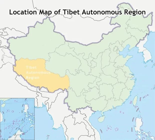
Map of Tibet Location in China
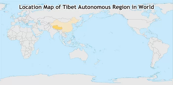
Tibet Location in Asia
2. Which Countries Border Tibet?
Tibet’s strategic location has made it an international crossroads for centuries. Four sovereign nations share land borders with Tibet:
India
- Border length: ~1,236 km along the southern and southwestern edges.
- Key crossing points: Nathu La (connecting to Sikkim) and Lipulekh (leading into Uttarakhand).
Nepal
- Border length: ~1,376 km southwest of Tibet.
- Major gateway: The Friendship Bridge at Zhangmu/Khasa, linking to Kodari, Nepal.
Bhutan
- Border length: ~477 km to the southeast.
- Rugged terrain: High passes and deep valleys form much of the frontier.
Myanmar (Burma)
- Border length: ~215 km along Tibet’s far southeastern tip in Chamdo Prefecture.
These frontiers historically facilitated trade in tea, salt, and precious stones, while also allowing for the spread of Buddhism between Tibet, Nepal, Bhutan, and northern India.
3. How Is Tibet Divided Administratively?
On a political map of China, Tibet is partitioned into six prefecture-level regions and its capital:
Capital
- Lhasa (拉萨市) sits at 3,658 m altitude and is home to roughly 560,000 residents. It serves as Tibet’s cultural, political, and economic hub.
Prefectures
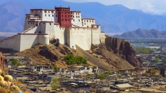
- Shigatse (日喀则) – Tibet’s second-largest city; home to Tashilhunpo Monastery.
- Ngari (阿里) – The “High West,” averaging over 4,500 m; hosts Mount Kailash and Lake Manasarovar.
- Shannan (山南) – The “Valley of Flowers”; birthplace of the Tibetan Empire’s first capital, Yarlung.
- Nagqu (那曲) – Dominated by grasslands and nomadic communities, sits above 4,500 m.
- Nyingchi (林芝) – The “Switzerland of Tibet,” lush river valleys average just 3,000 m.
- Chamdo (昌都) – Eastern gateway to Tibet, historically a corridor for cultural exchange.
Altogether, Tibet comprises 68 counties and 692 townships, each nestled within this extreme alpine environment.
Check out the 8-Day Classic Tibet Tour: Lhasa, Everest, Namtso & More
4. What Major Mountain Ranges and Peaks Define Tibet’s Topography?
Tibet’s dramatic relief rises from deep valleys to some of the planet’s tallest summits:
Himalaya Range (south):
- Mount Everest (8,844.43 m), the world’s highest peak, lies on the border of Shigatse Prefecture.
- Lhotse (8,516 m) and Makalu (8,463 m) also straddle the China–Nepal frontier.
Karakoram Range (west):
- K2 (8,611 m), the world’s second-highest mountain, lies just beyond Tibet’s western limits in Xinjiang.
Nyainqêntanglha Range (north of Lhasa):
- A series of high peaks exceeding 7,000 m.
Gangdise Range (west):
- Shelters sacred Mount Kailash (6,638 m) crowned by four towering faces.
Between these ranges, the Tibetan Plateau stretches like a vast tableland at an average elevation of 4,500 m, peppered with high plateaus, rolling grasslands, and turquoise lakes.
Check out the 10-Day Flight-and-Train Deluxe Tibet Tour: Lhasa, Everest, Namtso & More
5. Which Rivers Originate in Tibet?
Often called the “Water Tower of Asia,” Tibet feeds some of the world’s great rivers:
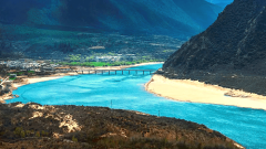
- Brahmaputra (Yarlung Tsangpo): Rises near Mount Kailash, flows east across southern Tibet, then turns south through India and Bangladesh.
- Yangtze (Chang Jiang): Emerges from high glaciers north of Lhasa, coursing eastward to the Pacific.
- Yellow River (Huang He): Begins on the northeastern plateau, arcing northeast across China’s heartland.
- Indus: Forms in western Tibet before descending through Ladakh into Pakistan.
- Mekong (Lancang Jiang) and Salween (Nu Jiang): Carve deep gorges along Tibet’s southeastern frontier toward Southeast Asia.
These rivers sustain over a billion people downstream, highlighting Tibet’s crucial role in Asia’s ecology.
6. What Is Tibet’s Climate Like?
Tibet’s climate varies dramatically with altitude and latitude:
- Northern & Western Plateau: Harsh, cold desert—mean annual temperature below 0 °C; minimal precipitation.
- Central Valley (around Lhasa): Semi-arid; warm sun, cool nights; annual rainfall ~450 mm.
- Eastern Highlands (Nyingchi, Chamdo): Subtropical monsoon-influenced; heavy summer rains; dense forests.
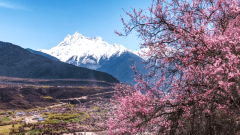
Seasons shift sharply: spring and autumn deliver clear skies, ideal for trekking and sightseeing; summer brings clouds and occasional rain; winter can plunge nighttime lows below –20 °C.
7. How Has Tibet’s Location Shaped Its Culture and Economy?
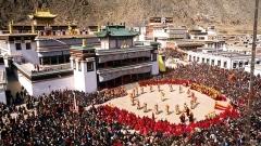
Cultural Influence
- Buddhism first arrived in Tibet via India and Nepal; today, 99% of ethnic Tibetans practice Tibetan Buddhism.
- Pilgrimage kora routes around Jokhang Temple in Lhasa or Mount Kailash draw devotees from Bhutan, India, and beyond.
- Artistic exchanges along historic trade routes enriched Thangka painting, mandala creation, and monastic rituals.
Economic Activities
- Agriculture & Animal Husbandry: Barley, wheat, and peas—alongside yak, sheep, and goat herding—form the livelihood of nomadic and village communities.
- Mineral Deposits: Tibet holds borax, uranium, iron, chromite, and other minerals, though extraction is limited by terrain and environmental concerns.
- Tourism: Growing infrastructure—roads, railways, airports—has made tourist services a pillar of the regional economy.
Check out the 11-Day Classic Panorama Tibet Tour: Lhasa, Everest, Nyingchi & More
8. What Wildlife Roams the Tibetan Plateau?
Few places match Tibet’s high-altitude biodiversity:
- Mammals: Wild yak, Tibetan antelope (chiru), Tibetan gazelle, Himalayan marmot, Tibetan wolf, snow leopard.
- Birds: Black-necked crane, Himalayan vulture, lammergeier (bearded vulture).
- Reptiles & Amphibians: Specialized species adapted to thin air and cold, such as the Himalayan toad.
Conservation areas like the Changtang Nature Reserve protect these fragile ecosystems, while sustainable tourism initiatives aim to secure local livelihoods.
9. Which Chinese Provinces Border Tibet – and What Attractions Lie Just Beyond?
Tibet connects by land to four Chinese provinces, each offering gateway highlights.
Sichuan
- Key Border Gateways: Chengdu→Kangding→Lhasa road
- Nearby Attractions: Giant Panda Base, Jiuzhaigou, Mt. Emei, Leshan Buddha, Huanglong
Yunnan
- Key Border Gateways: Dali→Shangri-La road
- Nearby Attractions: Old Town of Lijiang, Jade Dragon Snow Mountain, Tiger Leaping Gorge, Lugu Lake
Qinghai
- Key Border Gateways: Xining→Golmud→Lhasa Rail
- Nearby Attractions: Qinghai Lake, Kumbum Monastery, Kunlun Mountains, Qarhan Salt Lake
Xinjiang
- Key Border Gateways: Kashgar→Tashkurgan road
- Nearby Attractions: Karakoram Highway, Kizil Caves, Sunday Bazaar, Tianchi Lake
These routes blend cultural immersion with spectacular scenery, making overland journeys into Tibet unforgettable.
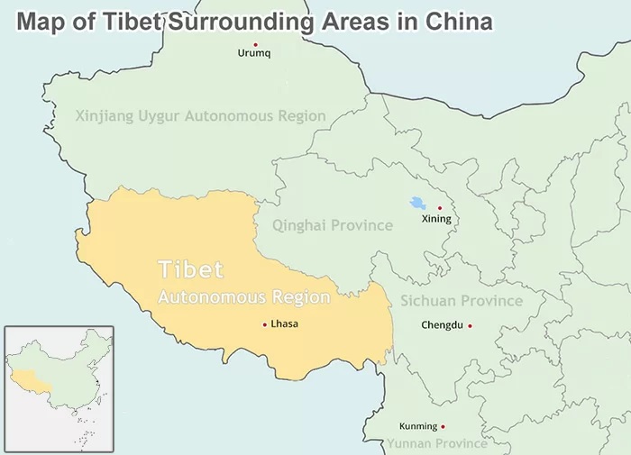
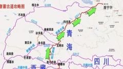
Map of Tibet Surrounding Areas in China
10. How China Dragon Travel Can Help You Navigate Tibet and Beyond
Whether you’re plotting a classic Lhasa to Everest Base Camp trek, a spiritual circuit around Mount Kailash, or a multi-region expedition crossing into neighboring Nepal or Sichuan, expert guidance makes all the difference. China Dragon Travel specializes in:
- Securing your Chinese visa and all necessary Tibetan permits
- Crafting individualized routes that respect acclimatization needs and cultural protocols
- Providing English-speaking, local guides steeped in Tibetan history and ecology
- Arranging comfortable accommodations, permits for restricted areas, and logistics for overland or air travel
With our deep knowledge of Tibet’s geography and its place on the broader Asian map, you can focus on the wonder of crystal-clear lakes, ancient monasteries, and towering peaks – while we handle every detail.