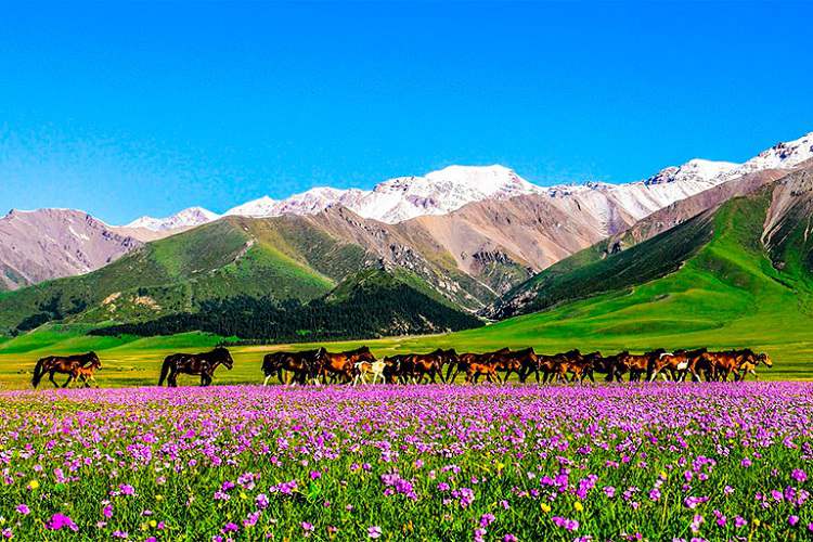
Xinjiang, China’s vast frontier in the far west, evokes images of golden deserts, towering mountain ranges and azure alpine lakes. Yet one question often lingers in would‑be visitors’ minds: “Will I suffer from altitude sickness in Xinjiang?” or “What is the altitude of Xinjiang?” In this comprehensive guide, you will learn about the altitude of most parts of Xinjiang and how to plan your trip in Xinjiang.
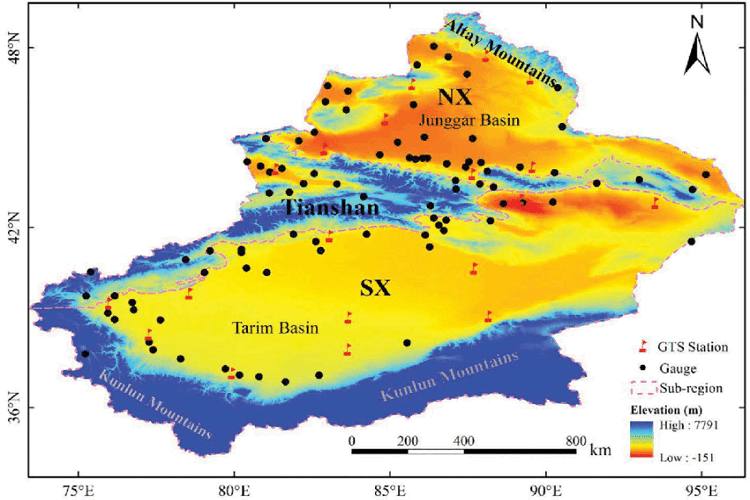
Xinjiang’s Dramatic Landscape: “Three Mountains, Two Basins”
Xinjiang is often described by geographers as “Three Mountains Encompass Two Basins”:
- Northern Range: Altai Mountains, straddling the border with Mongolia and Russia
- Central Spine: Tianshan Mountains, cutting east–west across the region
- Southern Barrier: Kunlun Mountains, rising behind the fabled Taklamakan Desert
Between these imposing ranges lie two vast basins:
- The Junggar Basin in the north, punctuated by desert and steppe
- The Tarim Basin in the south, dominated by the shifting sands of the Taklamakan
This arrangement shapes Xinjiang’s climate, hydrology and human settlement patterns. Cities like Ürümqi and Yining sit on the fringes of these basins at fairly modest elevations, while the highest peaks—such as K2 (Qogir Peak) and Bogda Feng—tower above 6,000 meters. But most travelers will never ascend that high.
Defining Altitude Sickness and Its Threshold
Altitude sickness, also known as acute mountain sickness (AMS), arises when the body struggles to adapt to lower oxygen levels at higher elevations. Symptoms can include headache, dizziness, nausea, fatigue and difficulty sleeping. In severe cases, it can lead to life‑threatening conditions like high‑altitude pulmonary edema (HAPE) or cerebral edema (HACE).
Here’s a rough breakdown of typical AMS risk zones:
- Below 2,500 m (8,200 ft): Minimal risk for most healthy travelers
- 2,500–3,500 m (8,200–11,500 ft): Mild to moderate risk; acclimatization recommended
- Above 3,500 m (11,500 ft): Increased risk; ascend slowly, stay hydrated, consider prophylactic medication
Because Xinjiang’s popular destinations—such as Ürümqi, Kashgar and Kanas Lake – mostly lie below 2,500 m, the vast majority of visitors experience no altitude issues. Only those who venture onto the Pamir Plateau (4,000–4,500 m) or attempt high mountain passes need to take serious AMS precautions.
Elevation of Major Xinjiang Destinations
Below is an overview of key cities, lakes and scenic spots, grouped by Southern and Northern Xinjiang, with their typical elevations:
Southern Xinjiang
| Destination | Elevation (m) | Notes |
|---|---|---|
| Hotan (Hetian) | 1,300 m | Oasis city on southern rim of Basin |
| Aksu City | 1,240 m | Silk Road hub |
| Korla | 500 m | Near Tianshan foothills |
| Bole | 807 m | Gateway to Altay region |
| Shihezi | 446 m | Modern agricultural town |
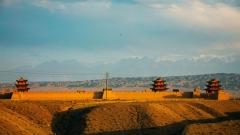
| Kuqa (Kuche) | 1,270 m | Site of ancient Buddhist caves |
| Hongshan Park (Ürümqi) | 600 m | City landmark overlooking Tianshan |
| Pamir Plateau | 4,000–4,500 m | High‑altitude frontier region |
Northern Xinjiang
| Destination | Elevation (m) | Notes |
|---|---|---|
| Tianchi (Heavenly Lake) | 1,927 m | Alpine lake, Tianshan National Park |
| Tacheng | 525 m | Steppe city near Kazakhstan border |
| Yabashi Snow Mountain | ~3,500 m | Part of Altai range |
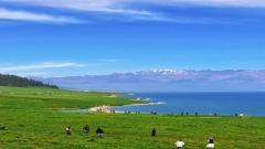
| Kanas Lake | 1,374 m | Famous for emerald water and forested hills |
| Kuqa Grand Canyon | 1,000 m | dramatic gorges, desert meets mountains |
| Burqin Five‑Color Beach | 1,300 m | River beach near Altai foothills |
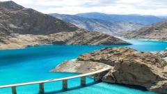
| Sayram Lake | 2,070 m | Highest alpine lake in Xinjiang |
| Taxkorgan (Pamir County) | 1,200–1,500 m | Last town before high Pamir passes |
| Kanas River Valley | 1,276 m | Scenic valley leading to Kanas Lake |
As you can see, almost every popular stop – aside from the Pamir highlands – sits comfortably below 2,500 meters, where altitude sickness is extremely unlikely for healthy visitors.
The Highest Peaks in Xinjiang: Qogir and Bogda
While most tourism focuses on lower elevations, Xinjiang boasts two of the world’s highest mountain summits:
- Qogir Peak (K2): 8,611 m, the planet’s second‑highest mountain
- Bogda Feng: 6,860 m, the highest point of Eastern Tianshan
These lofty summits attract professional climbers and high‑altitude expedition teams rather than casual sightseers. Unless you plan a mountaineering expedition, you won’t approach these heights.
Will You Experience Altitude Sickness in Xinjiang?
- Ürümqi (800–900 m): Virtually no risk—this modern city lies low in the Junggar Basin.
- Ili Kazakh Prefecture (530–1,000 m): Mild, rolling foothills; no AMS concerns.
- Sayram Lake (2,070 m): Gentle elevation—some may sense slight breathlessness on strenuous hikes but no true AMS.
- Kanas Lake (1,374 m) & Kashi Region (1,289 m): Comfortable heights for all travelers.
- Pamir Highlands (4,000–4,500 m): True high‑altitude zone—AMS precautions mandatory.
Bottom Line: Apart from dedicated high‑altitude treks on the Pamir Plateau or mountaineering missions to K2 and Bogda Feng, Xinjiang’s typical travel routes fall well below the AMS threshold. Most visitors enjoy clear skies and light air at these moderate elevations without ever experiencing altitude sickness.
Xinjiang’s Climate and Key Travel Tips
Xinjiang lies deep within the Eurasian continent, far from oceanic moisture. This continental setting creates:
- Arid Conditions: Low annual rainfall, dry air
- Intense Sunlight: Strong UV exposure at all altitudes
- Wide Temperature Swings: Hot days and brisk nights, especially in desert basins
- Abundant Sunshine: Over 2,500 sunny hours per year in many areas
To stay comfortable on your Xinjiang adventure:
- Dress in Layers: Mornings and evenings can be cool, while afternoons may be hot.
- Sun Protection: Wear broad‑brimmed hats, UV‑blocking sunglasses and apply high‑SPF sunscreen.
- Hydrate & Moisturize: Dry air can sap moisture—carry water and use lip balm and skin cream.
- Windproof Gear: Local winds can be brisk, especially near mountain passes.
- Acclimatize if Ascending: If traveling to ≥3,000 m (e.g., Kashi passes, small Pamir foothills), rest a day at intermediate altitude.
How China Dragon Travel Ensures a Safe, Enjoyable Xinjiang Journey
At China Dragon Travel, we specialize in crafting Xinjiang tours that balance epic landscapes with traveler well‑being:
- Elevation‑Smart Itineraries: Avoid abrupt altitude gains; build in rest days and acclimatization periods.
- Expert Local Guides: Experienced teams monitor guests for any signs of AMS and adjust plans accordingly.
- Comfortable Accommodations: From Urumqi’s city hotels to Pamir plateau yurt camps, we choose lodging that respects elevation and comfort.
- Customized Travel Styles: Half‑self‑guided to fully escorted tours—tailored to families, solo adventurers, cultural enthusiasts or active trekkers.
- Safety & Health Support: 24/7 emergency assistance, medical briefing and optional altitude‑sickness prophylaxis options.
Xinjiang’s topography spans from –155 meters below sea level in the Turpan Depression to over 8,600 meters atop Qogir Peak. Despite this staggering range, most travelers frame their adventures between 400 m and 2,500 m, where altitude sickness is virtually nonexistent. Armed with an understanding of these elevations and practical tips on acclimatization, you’re free to focus on the region’s rich cultural tapestry, mouthwatering cuisine and kaleidoscopic landscapes.
Ready to discover Xinjiang’s hidden treasures at the perfect elevation for you? Contact China Dragon Travel today, and let us elevate your journey – safely, comfortably and memorably.

![11 Day Tour[Winter Limited] Drunken Beauty Xinjiang Ice and Snow Kanas Fairy Tale New Vision](https://www.chinadragontravel.com/wp-content/uploads/2025/12/25cff76cef9e445-240x135.jpg)