The Yarlung Tsangpo River threads through the heart of the Tibetan Plateau like a wide, slow pulse of water and culture. Rising from glaciers above 5,000 meters on the northern slopes of the Himalayas, it becomes the lifeblood of southern Tibet before turning into the Brahmaputra and finally meeting the Bay of Bengal. For travelers, the river offers a unique combination of dramatic alpine scenery, deep spiritual meaning, ancient civilizations and rare wildlife.
Origin Of The Name – Sky River And A Cultural Label
The name Yarlung Tsangpo is steeped in language and legend. In Tibetan, terms that translate roughly as “coming from the sky” are attached to the river’s name, reflecting the belief that its source descends from the heavens. “Zangbo” simply means river — together the name evokes both a place and a cosmology: a watercourse born in the high glaciers and closely tied to the birthplaces of Tibetan civilization. For Tibetans the river is more than geography: it is the mother of valleys, a cradle of communities and a spiritual artery woven into stories, royal lineages and pilgrimage practices.
Yarlung Tsangpo River
Where Yarlung Tsangpo River Begins – The High Glacial Source
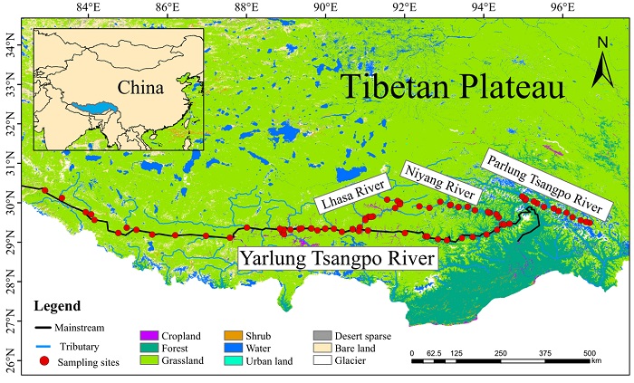
The Yarlung Tsangpo’s headwaters lie in the remote western reaches of Tibet’s Ngari Prefecture, fed by a cluster of high glaciers such as the Jiema Yangzong Glacier. Those glaciers and their cirques sit at elevations above 5,000 meters and collect snow and ice that feed the newborn stream. Two main tributary channels — from Jiema Yangzong and from Kubi Zangbo — converge in the uplands, creating a steady, clear river that at first is narrow, shallow and glass-like. In these upper stretches, the valley is wide, the water runs clean and wildlife is abundant. This glacier-fed origin is the starting point of a river that, over its entire course, will drop thousands of meters in elevation and reshape entire landscapes.
Yarlung Tsangpo River’s Course
To understand the Yarlung Tsangpo, it helps to break its flow into three parts: upper, middle and lower reaches. Each section has its own character, challenges and attractions for travelers.
Upper Reaches
Upstream the river is a collection of braided channels, lakes and rushing meltwater. This zone is sparsely populated and ecologically pristine. The channel widths are modest and the water is clear; surrounding meadows become havens for high-altitude wildlife when summer arrives. The terrain here is ideal for anyone drawn to quiet alpine landscapes, wildflower seasons and a feeling of being close to the source of a great river.
Midstream
As the Yarlung Tsangpo continues eastward, it gathers important tributaries — the Laka Zangbu, Nianchu, Lhasa and Niyang Rivers — and widens into broad valley plains. Towns such as Lhasa, Shigatse and Tsedang have developed on these fertile alluvial flats. Here the water slows and becomes more navigable for small craft, and the valley supports agriculture and the densest concentrations of Tibetan settlement. This middle region is the “granary” of Tibet: farmland, monasteries and market towns that make the river central to daily life.
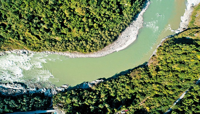
Lower Reaches And The Grand Canyon
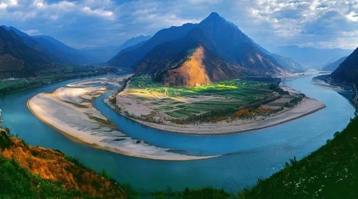
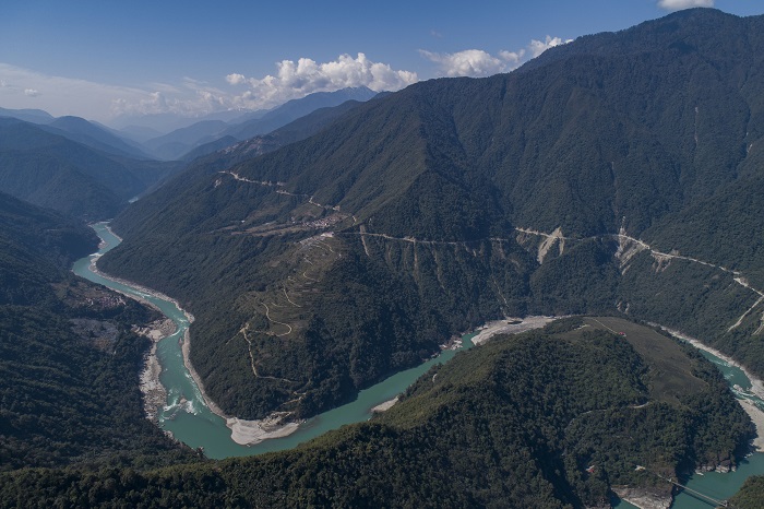
Beyond the agricultural plains the river turns dramatic. Near Namcha Barwa and Gyala Peri peaks the Yarlung Tsangpo dives into a deep, labyrinthine canyon — often called the Yarlung Tsangpo Grand Canyon — where the vertical drop reaches thousands of meters. This is one of the deepest canyons on the planet, and the river here is narrow, fast and wildly powerful. Rapids and reefs make navigation hazardous, and the surrounding cliffs and peaks produce spectacular, almost otherworldly scenery. After cutting through these gorges the river bends south and exits China near Pasighat, becoming the great Brahmaputra in India and ultimately the Jamuna in Bangladesh.
Yarlung Tsangpo River
Yarlung Tsangpo River’s Geography And Landscape
The river is squeezed between two monumental mountain systems: the youthful, towering Himalayas to the south and the Gangdise–Nyenchen Tanglha ranges to the north. That geography creates a narrow, long basin that runs east to west. The valley floor is relatively low and broad in places, enabling agriculture, settlements and monastery complexes to cluster beside the flow. Yet only a few hundred kilometers downstream, the terrain collapses into dramatic gorges. This rapid change — from broad pastoral valleys to the deepest canyon gashes in the world — defines the river’s dramatic contrast.
Cradle Of Tibetan Civilization – History Along The Banks
Human history along the Yarlung Tsangpo spans millennia. Archaeological finds in places such as Nyingchi and Motuo reveal Neolithic settlements and tools, pointing to a long human presence nourished by the river’s abundance. Later, as tribal confederations consolidated, the Yarlung valley emerged as the core of early Tibetan political life. Royal families, monasteries and administrative centers grew on the river’s plains; stories of ancient kings, alliances and royal marriages mark this landscape as culturally central. The river valley thus formed both the practical and spiritual basis of Tibetan civilization, earning it the reputation of “cradle” and “mother river.”
Yarlung Tsangpo River’s Spiritual And Cultural Significance
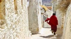
Buddhism is woven into the Yarlung Tsangpo’s identity. Monasteries, temples and sacred sites line the river’s route — from major centers like the Potala and Tashilhunpo to smaller temple complexes tucked into side valleys. Pilgrimage rituals, pujas and festivals are all tied closely to the river’s seasonal cycles, and locals continue to treat its waters and adjacent peaks with reverence. For visitors, this cultural dimension is as important as the scenic: to travel the Yarlung is to encounter centuries of devotion, ritual and living tradition.
Flora And Fauna – A High-Plateau Ecosystem
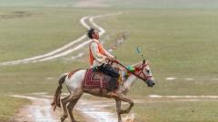
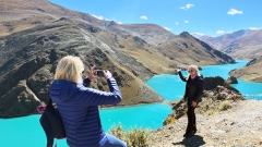
Despite the harsh climate at altitude, the Yarlung Tsangpo basin supports remarkable wildlife and vegetation. Above the river’s alpine headwaters and across its valleys you can find wild yaks, Tibetan antelope, blue sheep, Tibetan wild donkeys, foxes, pikas, marmots and even elusive snow leopards in higher, more remote ranges. The midstream valleys support grasses and pastures used for yak and sheep grazing, while lower, warmer pockets hold forests and more diverse plant life. For nature lovers and photographers the river corridor offers a rich palette of species adapted to high elevation.
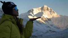
The Grand Canyon – One Of Earth’s Most Extreme Landscapes
The deepest section of the Yarlung Tsangpo canyon offers a spectacle few other river systems can match. As the river bends sharply near the Namcha Barwa and Gyala Peri peaks, the relief from summit to river bed measures several thousand meters. The canyon’s steep walls create dramatic light, sudden weather changes and rare microclimates that can surprise even experienced trekkers. While the canyon’s remoteness and technical difficulty limit mass tourism, specialized expeditions, scientific teams and adventurous river runners have been drawn here for decades. For many travelers, viewing the canyon from safe lookout points and experiencing nearby villages provides the best combination of awe and accessibility.
Navigation, Transport And Local Economy
Historically, sections of the Yarlung Tsangpo were navigable by leather or wooden boats, particularly across the gentler plains of the middle reaches. Today, road and air links are the modern lifelines: highways connect Lhasa, Shigatse and other valley towns, and domestic flights serve selected airports along Tibet’s spine. Agriculture on the valley floors feeds local populations, while monasteries and cultural tourism provide livelihood for many communities. In the canyon and lower reaches, the river’s power remains largely untapped for large-scale navigation due to rapids and complex terrain, but it plays a vital role in local hydrology and seasonal irrigation.
Best Time To Visit Yarlung Tsangpo River
For international visitors, timing is important. Late spring through early autumn — roughly May to October — provides the most favorable weather, with milder temperatures, clearer skies and easier travel conditions. Summer brings greener valleys and flowering meadows, while autumn ushers in dry air and excellent visibility for photography. Winter can close mountain passes and make travel hazardous. The canyon sections can have sudden local weather changes even within the “best” season, so plan flexibility into your itinerary.
Yarlung Tsangpo River’s Travel Tips For International Tourists
- Permit Requirements: Foreign visitors to Tibet generally must travel with a licensed local agency and obtain a Tibet Travel Permit before arrival. Major towns and attractions will expect official documentation.
- Acclimatization: Much of the Yarlung Tsangpo basin sits at high elevation. Take time in Lhasa or similar altitudes to acclimatize, hydrate, rest and avoid heavy exertion during the first 48–72 hours.
- Local Guides: Use experienced local guides who understand both the terrain and cultural protocols. Guides can ensure both safe passage and respectful interaction at religious sites.
- Cash & Supplies: Remote valleys have limited banking and medical facilities. Carry some local currency for small purchases and bring essential medications and supplies.
- Respect Local Customs: Ask permission before photographing people, support respectful clothing choices at monasteries and follow instructions during rituals or pujas.
- Health Insurance: Make sure your insurance covers high-altitude medical issues and potential evacuation.
Ways To Experience Yarlung Tsangpo River
Travelers can experience the Yarlung Tsangpo at many scales: a day trip from Lhasa to a river valley viewpoint, a multi-day cultural itinerary that includes Shigatse and Tsedang, or a specialized expedition that seeks canyon vistas and remote villages. Key stops often include:
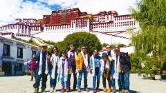
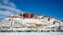
- Lhasa: The spiritual and administrative heart of Tibet, sitting on the river’s middle reach plains.
- Shigatse: A historic city with monastery life and agricultural plains nearby.
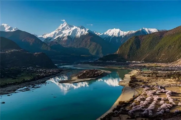
- Tsedang and Milin: Gateway towns closer to the canyon’s eastern approach.
- Nyingchi and Motuo: Forested lower-altitude valleys that feel distinct from the high plateau and are known for biodiversity.
Each of these nodes offers riverside culture, markets, monastery visits and opportunities to see how the river shapes daily life.
Yarlung Tsangpo River – A River Of Scenery And Spirit
The Yarlung Tsangpo is at once pragmatic and mythic: a supply line for valleys, a cradle for civilizations and a living symbol of Tibet’s natural and spiritual geography. To travel its length is to see how water sculpts society — from glacial trickles to a great river that eventually becomes the Brahmaputra — and to witness the interplay of mountains, monasteries and modern life. For international tourists drawn to remote beauty and cultural depth, the Yarlung Tsangpo offers an experience unlike almost any other river journey on Earth.
Plan Your Yarlung Tsangpo River Trip With China Dragon Travel
If you’d like professional help planning a Yarlung Tsangpo trip – whether a cultural circuit across Lhasa and Shigatse, an ecological side trip to Nyingchi or a canyon-viewing itinerary – China Dragon Travel can design a customized program for international visitors. We handle local permits, experienced guides, route planning and practical logistics so you can focus on the scenery and culture. Contact China Dragon Travel to build a safe, respectful and unforgettable journey along Tibet’s sacred “mother river.”