Stretching across the heart of Asia, the Qinghai‑Tibet Plateau soars to staggering heights and spans a vast expanse of rugged terrain. Often called the “Roof of the World” and “Third Pole,” it occupies roughly one‑third of the Earth’s land surface and boasts an average elevation exceeding 4,500 meters. From the sweeping alpine grasslands and crystal‑clear glacial lakes to the windswept permafrost and sacred mountain ranges, the Qinghai‑Tibet Plateau mesmerizes travelers with its breathtaking landscapes and ancient cultural heritage.
Where Is The Tibetan Plateau?
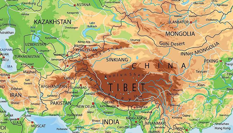
At approximately 2.5 million square kilometers, the Qinghai‑Tibet Plateau is not only the highest but also the largest plateau on the planet. Its vast territory stretches across the Tibet Autonomous Region and large sections of Qinghai, western Sichuan, southern Gansu, northwestern Yunnan, and the Ali area of Xinjiang in China. Beyond Chinese borders, pockets of this elevated realm extend into northern India (Ladakh, Himachal Pradesh), Bhutan, Nepal, Pakistan, Afghanistan, Tajikistan, and Kyrgyzstan.
Bordered by the Kunlun Mountains to the north, the Qilian Range to the northeast, and the majestic Himalayas and Karakoram to the south and southwest, the Qinghai‑Tibet Plateau forms a dramatic highland platform. Numerous mountain spurs such as the Hengduan Range bridge the Qinghai‑Tibet Plateau with the Yunnan‑Guizhou Plateau, carving deep alpine gorges and nurturing unique biodiversity.
Geographic Scope and Natural Boundaries of the Qinghai‑Tibet Plateau
Extent and Dimensions
Spanning roughly 2,500 kilometers from east to west and up to 1,000 kilometers from north to south, the Qinghai‑Tibet Plateau is defined by its abrupt rise from adjacent lowlands.
Surrounding Mountain Chains:
- Kunlun Mountains separate the plateau from the Tarim Basin.
- Altyn‑Tagh Range divides the eastern Tarim Basin from the plateau.
- Qilian Mountains form the northeastern boundary against the Gobi Desert.
- Himalayan and Karakoram Ranges shield the southern edge and feed perennial glaciers.
- Hengduan Mountains link the southeastern Qinghai‑Tibet Plateau to Yunnan’s rugged highlands.
The Third Pole
Beyond its soaring peaks, the Qinghai‑Tibet Plateau retains the world’s largest reserve of freshwater outside the polar regions. Rivers that originate here, such as the Yangtze, Yellow, Mekong, Salween, Brahmaputra, Indus, and Tarim, sustain billions of people across Asia.
Facts About The Plateau of Tibet
1. Qinghai‑Tibet Plateau Formation and Geological Evolution
The birth of the Qinghai‑Tibet Plateau is entwined with the dramatic collision of the Indo‑Australian and Eurasian tectonic plates roughly 70 million years ago. As the Tethys Sea between them narrowed over millions of years, immense compressive forces thrust granitic and basaltic masses upward into weakened sedimentary layers, gradually elevating the entire region.
Initial Uplift (70–50 million years ago): The converging plates compressed the Tethyan seabed, metamorphosing its sedimentary crust into rugged relief.
Plateau Emergence: Granitic intrusions and basalt upwelling propelled by tectonic thrusts raised the plateau floor, creating a mosaic of interlocking mountain blocks and basins.
Ongoing Rise: Today, the Indo‑Australian Plate continues to push horizontally beneath the Qinghai‑Tibet Plateau at an estimated rate of 5 millimeters per year, causing gradual uplift and seismic activity.
This dynamic geology makes the Qinghai‑Tibet Plateau one of the most seismically active regions on Earth, with frequent earthquakes shaping its evolving topography.
2. Qinghai‑Tibet Plateau Climate: A High‑Altitude Desert
Dominated by a high‑altitude arid climate, the Qinghai‑Tibet Plateau endures intense solar radiation, wide temperature swings, and scant precipitation.
Temperature Extremes: Annual averages range from 5.6°C to 8.8°C, but nights can plunge rapidly, and in the Changtang region temperatures fall below ‑40°C during winter.
Low Precipitation: Blocked by the Himalayas, monsoon rains rarely infiltrate the plateau, with annual totals falling between 100 and 300 millimeters, often as hail.
Permafrost and Snow Cover: Large swaths of the Qinghai‑Tibet Plateau remain under permafrost, while glaciers in high mountain valleys persist year‑round.
Solar Radiation: Thinner atmosphere allows greater UV exposure, a key consideration for visitors unaccustomed to high‑altitude environments.
3. Qinghai‑Tibet Plateau Flora and Fauna: Life Above 4,000 Meters
Despite its harsh conditions, the Qinghai‑Tibet Plateau is home to diverse ecosystems. Montane grasslands dominate the landscape, punctuated by alpine tundra, shrublands, and scattered coniferous forests in monsoon‑influenced valleys.
Key Vegetation Zones:
- Montane Grasslands: Vast expanses of hardy grasses and sedges support grazing herbivores.
- Alpine Tundra: Lichens, mosses, and dwarf shrubs cling to wind‑swept slopes.
- Forest Pockets: Spruce, fir, and juniper thrive in southern valleys with higher rainfall.
Iconic Wildlife:
- Mammals: Snow leopard, Tibetan wolf, wild yak, kiang (wild donkey), and Tibetan antelope.
- Birds: Bar‑headed geese, black‑necked cranes, lammergeier (bearded vulture), and golden eagles.
- Specialized Species: Himalayan jumping spider (Euophrys omnisuperstes) and endemic reptiles adapted to extreme altitudes.

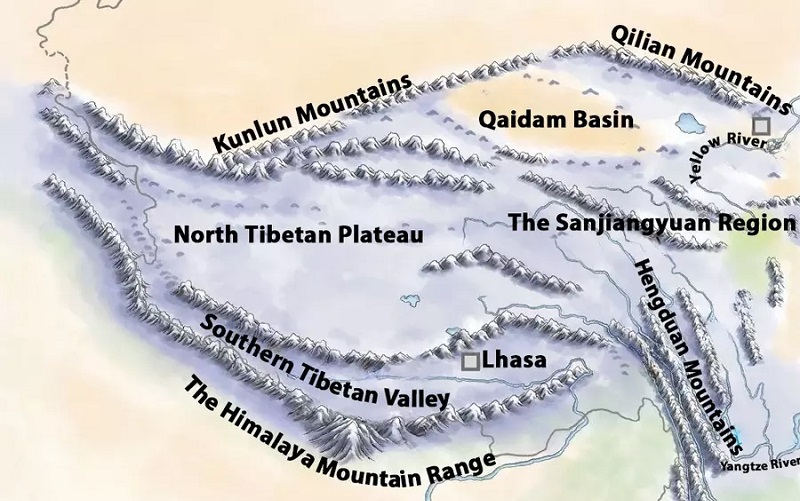
4. Six Geographical Regions of the Qinghai‑Tibet Plateau
Northern Tibetan Plateau: The core highland area encircled by the Kunlun, Tanggula, and Gangdise ranges, with an average altitude of 4,500 meters.
Southern Tibetan Valleys: Carved by the Yarlung Tsangpo (Brahmaputra) River, this 1,200‑kilometer‑long valley boasts lower elevations (3,000–4,000 meters) and fertile floodplains.
Qaidam Basin: China’s largest plateau basin, 800 by 400 kilometers, featuring salt flats, brackish lakes, and mineral‑rich depressions.
Qilian Mountain Belt: Fault‑block ranges northeast of the plateau, with peaks exceeding 5,000 meters and intermontane basins at 3,000–4,000 meters.
Qinghai Plateau: Northeast sector bounded by the Kunlun and Qilian ranges, with altitudes around 4,000 meters and peaks surpassing 6,800 meters.
Sichuan‑Tibet Alpine Canyons: A labyrinth of deep gorges and high peaks in western Sichuan and eastern Tibet, housing dramatic river canyons such as those of the Jinsha and Dadu Rivers.
5. Qinghai‑Tibet Plateau Cultural and Spiritual Landscapes
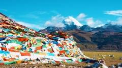
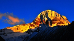
Beyond its physical grandeur, the Qinghai‑Tibet Plateau is the cradle of Tibetan Buddhism and ancient nomadic cultures. Lhasa, the spiritual capital, presides over a network of monasteries, pilgrimage routes, and sacred mountains like Kailash. Nomadic pastoralists continue age‑old traditions, migrating seasonally with their yaks, sheep, and goats.
Monasteries and Pilgrimages: Jokhang Temple, Tashilhunpo, and the Rongbuk Monastery near Everest base camp are vital spiritual centers.
Pilgrim Routes: Kora circumambulation paths around sacred peaks foster cultural continuity and communal gatherings.
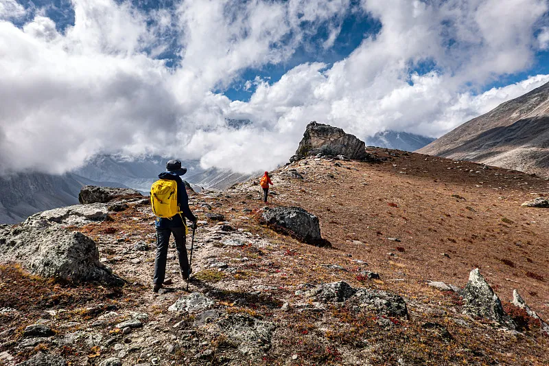
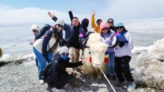
6. Qinghai‑Tibet Plateau Tourism Highlights and Practical Tips
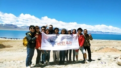
Travelers to the Qinghai‑Tibet Plateau can immerse themselves in unparalleled scenery and cultural richness. Spend several days in Lhasa (3,650 meters) to adjust to altitude before venturing higher. Must‑See Destinations:
- Potala Palace: Former residence of the Dalai Lama, an icon of Tibetan architecture.
- Namtso Lake: One of the highest saltwater lakes, famed for its turquoise waters.
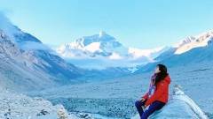
- Mount Everest Base Camp (North): Gateway for mountaineers and spectators alike.
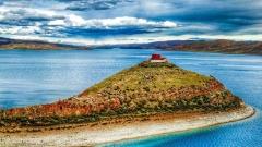
- Qinghai Lake: China’s largest inland lake on the northeastern plateau.
Best Seasons: May to October offers milder weather and clearer skies, while winter unveils stark landscapes and fewer crowds.
Conclusion and China Dragon Travel Recommendation
With its soaring peaks, vast grasslands, and vibrant cultural tapestry, the Qinghai‑Tibet Plateau stands as one of the world’s most awe‑inspiring frontiers. Exploring this highland realm offers a journey through time and nature, where geological wonders and spiritual heritage converge.
For an expertly curated adventure across the Roof of the World, consider China Dragon Travel. Our tailored itineraries ensure safe acclimatization, deep cultural engagement, and seamless logistics—all designed to bring the grandeur of the Qinghai‑Tibet Plateau to life.