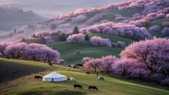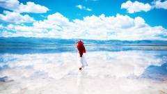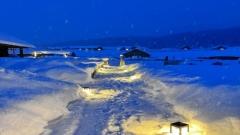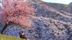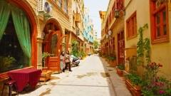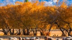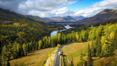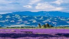

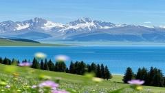
Northern Xinjiang can bring Switzerland to mind: snow-bright peaks rise above green meadows, dark forests fringe clear lakes, and small settlements sit beneath immense mountain horizons. But the resemblance is only a starting point. This part of China has a continental climate, vast distances, Kazakh pastoral traditions, and landscapes that shift from alpine scenery to desert and dry steppe. The comparison is useful for imagining the scenery, but it does not capture the region’s full character—or the practicalities of getting around.
Key Takeaways
- Alpine scenery across the Altai and Tianshan ranges
- Lakes and grasslands shaped by elevation and season
- Much larger distances than a compact European itinerary
- Kazakh culture and local food alongside the views
- Weather, road conditions, and permits worth checking ahead
The landscape behind the comparison
The phrase “Switzerland of China” is often used to describe northern Xinjiang’s mountain scenery, particularly the Altai region around Kanas and Hemu. It is an evocative shorthand, not a geographic or cultural equivalence. Switzerland is a relatively compact, densely connected country in central Europe. Northern Xinjiang is a broad part of China’s largest provincial-level region, where dramatic scenery may be separated by long drives and wide stretches of open land.
The visual resemblance comes from a combination of high mountains, seasonal snow, lakes, conifer forests, and grazing land. These features are familiar from Alpine landscapes, yet northern Xinjiang’s scale and setting are distinctly Central Asian. Valleys open broadly, settlements can be far apart, and the horizon often feels more expansive than enclosed.
The region is also not one continuous postcard landscape. Northern Xinjiang includes the Altai Mountains in the north, the Junggar Basin, and parts of the Tianshan range farther south. A trip linking Urumqi, the Ili Valley, and the Altai may reveal alpine lakes, flower-filled summer meadows, dry plains, and forested slopes. That variety is part of the appeal, but it also means a single viewpoint cannot stand in for the entire region.

Kanas Lake scenery in Northern Xinjiang spring
Why the mountains, lakes, and meadows look familiar
Altai peaks and forested slopes
The Altai Mountains form a borderland range shared by several countries, including China, Kazakhstan, Mongolia, and Russia. On the Chinese side, around Altay Prefecture, the terrain includes high ridges, river valleys, and forests of spruce and other conifers. In the warmer months, green slopes and grazing animals soften the mountain profile. In colder seasons, snow alters the same landscape into a quieter, more austere scene.
This mix of alpine relief and forest cover is one reason travelers make the Swiss comparison. Yet the Altai’s ecological setting and local history are its own. The mountains connect communities and trade routes across Central Asia, and the area has long been associated with pastoral life. Travelers who look beyond the scenery will find a landscape shaped as much by movement and livelihood as by geology.
Lakes that reflect the changing light
Kanas Lake is among the region’s best-known destinations. It lies within the Kanas scenic area in Altay Prefecture, surrounded by forested mountains. Its water can appear blue, green, or slate-colored depending on the light, weather, and viewing angle. Nearby viewpoints and walking routes offer different perspectives, while the broader area includes rivers, wooded valleys, and smaller settlements.
Tianchi, or Heavenly Lake, is another widely visited mountain lake, located in the Tianshan range east of Urumqi. It is a convenient choice for travelers who want a high-mountain setting without going as far north as Kanas. The two destinations are not interchangeable: Kanas is part of a larger northern itinerary, while Tianchi is commonly visited as a day trip or short excursion from Urumqi.
Lake color is not a fixed feature, and photos can create unrealistic expectations. Cloud cover, season, water conditions, and the position of the sun all affect what a visitor sees. A flexible schedule and time to explore on foot are more useful than chasing one supposedly perfect viewpoint.
Grasslands that change with elevation
Grasslands give northern Xinjiang some of its most memorable seasonal contrast. In summer, alpine pastures become green and may be dotted with wildflowers. Horses, sheep, and cattle are a familiar sight in pastoral areas. As the season advances, vegetation changes color, and the landscape can turn gold before autumn gives way to colder weather.
The Ili Valley, southwest of Urumqi and closer to the Kazakhstan border, is known for open grasslands, cultivated fields, and mountain scenery. Places such as Nalati and the surrounding pasturelands offer a different look from the forested valleys near Kanas. The experience depends on altitude and local conditions: a lower valley may be warm while a mountain pass remains chilly, even during the same trip.
Climate and seasons: the scenery is not the same all year
Northern Xinjiang has a continental climate, with marked differences between seasons and between lowlands and mountain areas. Summer generally brings the most accessible conditions for outdoor travel, with green pastures and relatively long daylight hours. However, the region is large, and temperatures can vary considerably between Urumqi, the Ili Valley, and higher parts of the Altai.
Autumn is especially popular around Kanas and Hemu because forests and riverside vegetation take on rich seasonal colors. The window for peak foliage is short and can vary from year to year with weather. Travelers should avoid relying on a fixed date promoted in old itineraries; local conditions can shift the timing. Autumn also brings cooler nights and a greater chance of early snow at elevation.
Spring can be unpredictable. Some mountain areas remain cold or snow-covered while lower regions begin to warm. In winter, the region offers snow scenery and cold-weather activities in suitable locations, but travel requires more preparation. Road conditions, daylight, and service availability may differ from summer, so visitors should confirm what is operating before setting out.
Whatever the season, pack layers. A warm outer layer, comfortable walking shoes with grip, sun protection, and rain protection are sensible choices. Mountain weather can change quickly, and a sunny morning does not guarantee a warm evening. If an itinerary includes high viewpoints or long drives, keep water and basic supplies accessible rather than packed out of reach.
What makes Northern Xinjiang different from Switzerland
Scale and travel time
The most practical difference is distance. Northern Xinjiang covers a vast area, and a scenic route on a map may involve many hours on the road. Urumqi is a common arrival point, but the Altay region is far to the north, while the Ili Valley lies in another direction. Trying to combine every headline destination in a short visit can turn a landscape trip into a sequence of long transfers.
A sensible plan groups nearby places. Travelers focused on Kanas and Hemu can build an Altay-centered itinerary. Those with fewer days may prefer Tianchi and destinations closer to Urumqi. Visitors interested in the Ili Valley can devote several days to that region instead of treating it as a quick detour between distant stops. Allowing spare time helps absorb weather changes, road delays, and the simple pleasure of stopping when a valley or village catches your attention.
A Central Asian cultural landscape
Xinjiang is home to diverse communities and traditions. In northern areas, Kazakh pastoral culture is an important part of the region’s identity. Depending on where you travel and what is locally available, visitors may encounter yurts used for seasonal or tourism purposes, traditional music, horse culture, and dairy-based foods. These experiences are not props for a landscape photograph; they are part of living communities, and respectful travel means asking before taking portraits and following local guidance.
The food also reflects the region’s geography and cultural mix. Lamb, beef, wheat-based staples, noodles, and dairy products are common across many local menus, though dishes vary by place and restaurant. Uyghur cuisine is also prominent across Xinjiang, including hand-pulled noodles and baked breads. Rather than assuming that every town serves the same dishes, treat meals as part of the itinerary and try local specialties where they are available.
A wider range of environments
Switzerland is known for its Alpine landscapes, but northern Xinjiang offers a broader transition between mountain environments, basins, grasslands, and dry country. A traveler can move from a forested lake to open steppe and then toward arid terrain over the course of a longer route. The contrasts are not always dramatic within a single day, but they are central to understanding the region.
That variety explains why the comparison works in one sense and falls short in another. The mountains and lakes may look familiar to someone who knows the Alps, while the scale, climate, vegetation, and cultural context feel unmistakably different. The best approach is to use “like Switzerland” as a visual clue, then travel with an open mind.

Northern Xinjiang characteristic Mongolian yurt
Places to consider for a first visit
Kanas and Hemu
Kanas is a strong choice for travelers seeking a combination of lake scenery, forest, and mountain viewpoints. Hemu, a village in the broader Altay area, is known for its wooden houses and surrounding valley landscape. The area can be busy during popular travel periods, so visitors who prefer quieter walks may benefit from starting early, staying overnight where practical, and allowing time beyond the main viewing stops.
Access arrangements and visitor services can change, especially in remote scenic areas. Check current transport, entry, and accommodation details before traveling. It is also worth confirming whether a planned road route is open and what transfer arrangements are required within a scenic zone.
Tianchi near Urumqi
Tianchi is a practical addition for visitors with limited time or those beginning and ending their trip in Urumqi. The lake’s mountain setting makes it a useful introduction to the region’s alpine scenery. A day trip is possible for many itineraries, although the experience is more comfortable when the schedule allows for weather and transport conditions rather than forcing a quick turnaround.
The Ili Valley and Nalati
The Ili Valley offers a different perspective on northern Xinjiang: open pastoral landscapes, cultivated land, and mountain backdrops. Nalati is one of the best-known grassland destinations in the area. A visit can be rewarding for travelers who want to see the region’s summer meadows and learn about local pastoral life, rather than focusing only on lakes and forests.
The Ili Valley and Kanas are not neighboring stops. If both are on your wish list, plan enough days for the transfers or consider a route with appropriate transport connections. Building the itinerary around geography is more comfortable than choosing destinations solely because they appear together in a list.
A practical route-planning approach
For a trip of several days, choose one main landscape area and add nearby stops. A Urumqi-based visit can include Tianchi and local city experiences. A longer northern itinerary can focus on Altay, Kanas, and Hemu. A separate journey toward the Ili Valley can center on grasslands and valley scenery. The exact order depends on transport connections, season, and the amount of driving you are comfortable with.
Travelers can use a mix of domestic flights, trains, private vehicles, and local transfers, depending on the route. Public transport may be available between major centers, while scenic areas often require additional ground transport. A private vehicle can provide flexibility but does not eliminate the need to check road conditions, local driving rules, and access restrictions. If you are unfamiliar with long-distance driving in the region, a reputable local operator or experienced driver may make the journey easier.
China Dragon Travel can be considered when arranging a tailored Xinjiang itinerary, especially if you want help coordinating multiple destinations, transport, and local logistics. Before booking with any operator, confirm exactly what is included, the cancellation terms, accommodation standards, group size, and whether the itinerary leaves room for weather-related changes. Ask for realistic driving times rather than relying only on a list of scenic stops.
Responsible and comfortable travel
Northern Xinjiang’s natural areas are valuable ecosystems and, in some locations, part of protected scenic zones. Stay on marked paths, follow instructions from local authorities and site staff, and avoid disturbing wildlife or livestock. Take rubbish with you, and do not assume that a remote-looking area is a suitable place to camp or light a fire.
Be considerate around homes, herding areas, and cultural sites. Ask permission before photographing people, especially children, and be prepared to accept a refusal. Dress for conditions rather than for a single photograph, and respect local rules about access. In remote areas, mobile coverage may be inconsistent, so share your route with someone and carry essential information offline.
Visitors should also verify current travel requirements and local arrangements through official channels before departure. Entry procedures, scenic-area rules, transport schedules, and accommodation availability can change. This is particularly important for international travelers, who should check the latest visa and registration requirements applicable to their circumstances. Avoid planning around unverified online claims about access or operating hours.
Frequently asked questions
Why is Northern Xinjiang compared with Switzerland?
The comparison refers mainly to mountain scenery: snow-capped peaks, forested slopes, clear lakes, and green pastures. It is a visual shorthand, not a claim that the regions have the same climate, culture, or geography. Northern Xinjiang is much larger and includes a wider range of landscapes.
What is the best season to see the green grasslands?
Summer is generally the best period for green pastures and outdoor access, but exact conditions vary with elevation and weather. Check local forecasts and destination updates close to your trip. Autumn is popular for foliage in parts of Altay, though the color window can shift each year.
How many days should I allow?
There is no single ideal duration because the region is so large. A short visit can focus on Urumqi and Tianchi, while Kanas, Hemu, or the Ili Valley each need more time and involve longer transfers. Choose fewer areas and allow realistic travel days instead of trying to cross the region in a rush.
Is Kanas the same as Tianchi?
No. Kanas is in Altay Prefecture in northern Xinjiang and is usually part of a longer northern itinerary. Tianchi is in the Tianshan range east of Urumqi and is more accessible as a short excursion from the city. Both are mountain lakes, but their settings and travel logistics differ.
Is Northern Xinjiang suitable for independent travel?
Independent travel can work for visitors who are comfortable managing long distances, transport changes, and local rules. Remote routes require careful planning, and some scenic areas have designated transport or access procedures. Confirm current arrangements in advance, keep backup time in your schedule, and consider a local driver or tour operator if the logistics feel difficult.