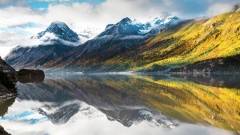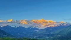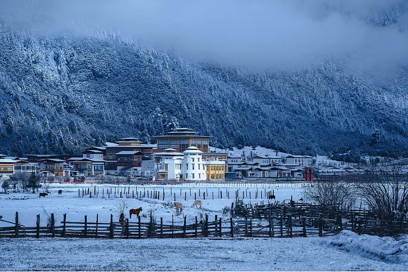

The Nyenchen Tanglha Mountains are one of the most important sacred mountain ranges in Tibet.
When most travelers plan their first trip to Tibet, they usually focus on famous destinations such as Mount Everest, Namtso Lake, and Mount Kailash. However, for travelers who want to experience the most authentic, wild, and peaceful side of Tibet, the eastern section of the Nyenchen Tanglha Mountains — including Lolong, Bianba, and Gyari — offers an unforgettable adventure.
Unlike popular tourist areas, this region remains quiet and largely undeveloped.
Here you will find:
- Endless snow-covered peaks
- Ancient valleys
- High-altitude lakes
- Traditional Tibetan villages
- Sacred mountains surrounded by legends
- Hidden hot springs known mainly by local residents
With the improvement of the Sichuan–Tibet Central Route, a new self-driving route has attracted more attention from adventure travelers — Provincial Highway S303 from Bomi to Lolong.
This road crosses the Nyenchen Tanglha Mountains from south to north, covering around 250 kilometers in one day.
Along the way, the landscape changes dramatically:
From humid forests and peach blossom valleys in eastern Tibet, to snow-covered mountains, dry canyons, and the vast wilderness of northern Tibet.
This is one of the most rewarding off-the-beaten-path routes for deep Tibet exploration.
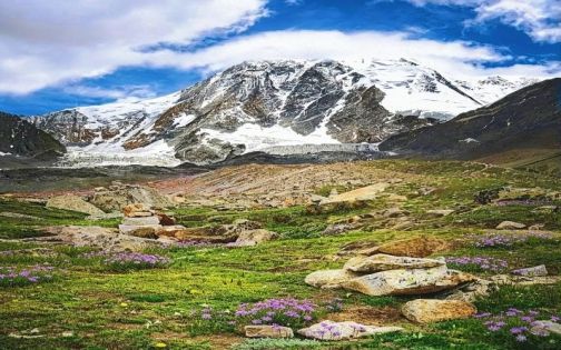
Nyenchen Tanglha Mountains
1. About the Nyenchen Tanglha Mountains: A Sacred Mountain Range of Tibet
The Nyenchen Tanglha Mountains are located in central Tibet and stretch approximately 700 kilometers from east to west.
The main peak, Nyenchen Tanglha Peak, reaches an altitude of about 7,111 meters, making it one of Tibet’s most iconic mountains.
The name “Nyenchen Tanglha” has deep cultural meaning.
In Tibetan language, “Nyenchen” means “the younger relative” or “secondary,” referring to its relationship with the broader Tanglha mountain system. The mountain is also regarded as a powerful deity symbolizing protection and brightness.
For Tibetan people, Nyenchen Tanglha is not simply a mountain range.
It is a sacred spiritual symbol.
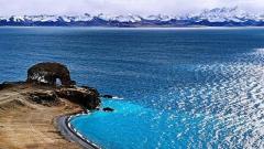
According to Tibetan legends, Nyenchen Tanglha Mountain and Namtso Lake are a divine couple:
- The mountain represents the powerful husband.
- The lake represents the beautiful wife.
The snow peaks protect the holy lake, while the lake reflects the mountain’s beauty.
Together, they form one of the most romantic natural landscapes in Tibet.
In the traditions of Bon religion and Tibetan Buddhism, Nyenchen Tanglha is also an important pilgrimage and meditation site.
The prayer flags, Mani stones, monasteries, and sacred lakes along the route all carry centuries of Tibetan spiritual traditions.
2. S303 Crossing the Nyenchen Tanglha Mountains: The Most Scenic Road from Bomi to Lolong
Most travelers entering eastern Tibet choose National Highway 318.
However, if you have enough time, the S303 route from Bomi to Lolong is highly recommended.
The biggest attraction of this road is the incredible landscape transformation within a single day.
Route:
Bomi → Songzong Township → Duoji Township → Guozangla Tunnel → Lolong County
Total distance:
Approximately 250 km.
Road conditions:
- Newly paved asphalt road
- Mostly two-lane highway
- Suitable for experienced self-driving travelers
However, keep in mind:
- Altitude rises quickly
- Some areas have weak mobile signals
- Winter snow and ice may affect driving
- Avoid driving after dark
3. Starting from Bomi: Entering the Snow Mountains Through Peach Blossom Valleys
Leaving Bomi, follow National Highway 318 toward Songzong Township.
After reaching the junction, follow the signs toward Duoji Township and begin the S303 journey.
The first section follows the Quzong Zangbu River Valley.
This area represents the typical landscape of southeastern Tibet:
- Dense forests
- Flowing rivers
- Tibetan villages
- Snow mountains
- Peach blossoms in spring
Every year from late March to April, Bomi becomes one of Tibet’s most famous peach blossom destinations.
Unlike traditional flower parks, the peach blossoms here grow naturally among villages, rivers, and snow peaks.
On clear days, the surrounding mountains reveal their true beauty.
Compared with summer, spring and autumn usually offer better visibility of the snowy peaks.
4. Crossing Guozangla Tunnel: The Most Beautiful Section of S303
After leaving the river valley, the road begins a continuous climb.
Near Duoji Township, the scenery gradually changes into alpine forest landscapes.
This is the most spectacular section of S303.
Along the route, travelers can see:
- Ancient forests
- Massive snow peaks
- Glacial valleys
- Alpine grasslands
As altitude increases, snow mountains appear closer and more dramatic.
The highest section reaches the Guozangla Tunnel area at around 4,500 meters elevation.
Standing here, you can truly feel the scale of the Nyenchen Tanglha Mountains.
The mountains rise dramatically on both sides, creating a powerful sense of wilderness.
If the weather is clear, this is one of the best photography locations on the entire route.
However:
Do not stay too long at high altitude areas.
Avoid intense activity and strong winds.
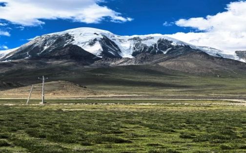
Nyenchen Tanglha Mountains
5. From Snow Mountains to Northern Tibet: Entering Lolong’s Dry Valleys
After passing through Guozangla Tunnel, the landscape changes completely.
The southern and northern sides of the Nyenchen Tanglha Mountains have very different climates.
Southern side — Bomi:
- More rainfall
- Dense forests
- Green valleys
- Peach blossoms
Northern side — Lolong:
- Dry climate
- Open landscapes
- Rocky mountains
- Deep valleys
Within only a few hours, travelers experience two completely different worlds.
During spring, many hillsides around Lolong are covered with apricot blossoms.
Compared with the famous peach blossoms of Nyingchi, Lolong’s apricot forests remain much more peaceful and natural.
There are no large crowds.
Only villages, mountains, rivers, and traditional Tibetan life.
6. Lolong County Travel Guide: The “Granary of Eastern Tibet” and Apricot Blossom Paradise
Located in northern Chamdo Prefecture, Lolong County is an important stop along the Sichuan–Tibet Central Route.
Because of its relatively flat valleys, abundant water resources, and suitable agricultural conditions, Lolong is known as the “Granary of Eastern Tibet.”
Many travelers only use Lolong as a transit point, but this peaceful county deserves more time.
Recommended experiences include:
1. Lolong Apricot Blossom Season
Every spring, villages around Lolong, especially the Oxi Township area, become covered with blooming apricot flowers.
The scenery combines:
- Snow-covered mountains
- Tibetan villages
- Rivers
- Traditional farmland
- Pink and white apricot blossoms
Compared with more famous destinations such as Nyingchi’s peach blossom valleys, Lolong offers a more authentic experience.
There are fewer tourists, fewer commercial activities, and a stronger connection with local Tibetan life.
Best viewing period:
Late March to mid-April
(The exact flowering period changes depending on yearly temperatures.)
2. Lolong Valley Landscapes
The valleys surrounding Lolong are wide and open.
The biggest charm here is not a single famous attraction, but the feeling of endless space.
Sunrise and sunset are the best moments for photography.
Golden sunlight spreads across the mountains, villages, and grasslands, creating a peaceful Tibetan landscape.
7. Hidden Natural Hot Springs Beneath Nyenchen Tanglha Mountains
Deep in the Nyenchen Tanglha Mountains, there are several natural hot springs that remain unknown to most travelers.
Unlike commercial hot spring resorts, these are traditional local bathing places used by nearby residents for generations.
Their greatest attraction is their untouched nature.
The surroundings include:
- Red-brown natural rocks
- Mani stones carved with Tibetan scriptures
- Vast highland wilderness
- Small Tibetan temples in the distance
- Snow mountains rising behind the valley
The atmosphere is completely different from developed tourist sites.
There may be no luxury facilities, but that is exactly what makes the experience special.
The hot spring water often contains natural minerals and has a noticeable sulfur smell.
After several days of high-altitude driving, soaking in warm mineral water while looking at snow peaks in the distance is one of the most unforgettable experiences in eastern Tibet.
Local hot springs usually charge only a small entrance fee.
High-Altitude Hot Spring Safety Tips
Although soaking in a mountain hot spring is relaxing, high-altitude conditions require caution.
1. Do not enter immediately after a long drive
After hours of driving, your body needs time to recover.
Rest first until your breathing and heart rate return to normal.
2. Avoid staying too long
Recommended soaking time:
15–20 minutes per session
Long exposure may cause fatigue at high altitude.
3. Keep warm after leaving the water
The biggest danger is not inside the hot spring, but after getting out.
Strong mountain winds can quickly lower body temperature.
Bring:
- Warm jacket
- Towel
- Slippers
- Extra dry clothes
4. Be prepared for traditional bathing customs
Some wild hot springs maintain local traditions.
Usually:
- Men and women have separate areas
- Facilities are simple
- Privacy conditions are basic
Travelers should prepare mentally before visiting.
8. Gyari Bunang Valley: Facing Three 6,000-Meter Snow Mountains
For travelers who want to truly explore the Nyenchen Tanglha Mountains, Bunang Valley in Gyari County is one of the most impressive hidden destinations.
Compared with famous Tibetan attractions such as Mount Everest and Namtso Lake, this area remains extremely quiet and wild.
The highlight of Bunang Valley is the magnificent snow mountain group known as the “Three Eastern Tibet Sword Peaks.”
They include:
- Kajagjo (Qia Jia Jue Wo): 6,447 meters
- Manazhuo (Mu Na Que Wo): 6,264 meters
- Bacuoluozan (Zhasuoer Luzan): 6,144 meters
These three giant peaks rise above the primitive valley landscape.
Among them, Manazhuo Peak has been compared by some travelers to the “Matterhorn of the East” because of its unique shape.
9. Bunang Valley Trekking Guide
Destination
Bunang Valley, Gyari County, Nagqu Prefecture, Tibet.
Transportation
From Gyari County:
Drive toward Bada Village.
Follow National Highway 349 for about 30 km.
Look for a side road on the right.
After crossing a concrete bridge, enter a dirt road.
Drive approximately 10 km to Yilongdu.
This is the furthest point accessible by vehicle.
Altitude:
Approximately 4,430 meters
There are only a few local households here.
Parking is possible.
Hiking Route
Starting point:
4,430 meters
Destination:
High-altitude lake at approximately 4,780 meters
Distance:
Around 8 km round trip
Duration:
About 4–5 hours at a slow pace
The route is undeveloped but the general trail is visible.
Two Hiking Options
Option 1: Follow the Xiudachu River Valley
Advantages:
- Easier walking
- Less elevation gain
- Suitable for travelers with less hiking experience
Disadvantage:
- Lower viewpoint
- Limited views of the mountains
Option 2: Walk along the hillside route
Recommended.
Although it requires more climbing, the higher viewpoint provides much better scenery.
You can see:
- Glacier lakes earlier
- Wider mountain views
- Better photography angles
Best Photography Position
For photographing the lake reflection:
Do not stay only at the lakeshore.
A better viewpoint is:
Approximately 500 meters before the lake, climb 150–200 meters upward.
From the higher rocks, you can capture:
- Blue alpine lake
- Glacier scenery
- Three giant snow peaks
This is the most impressive composition.
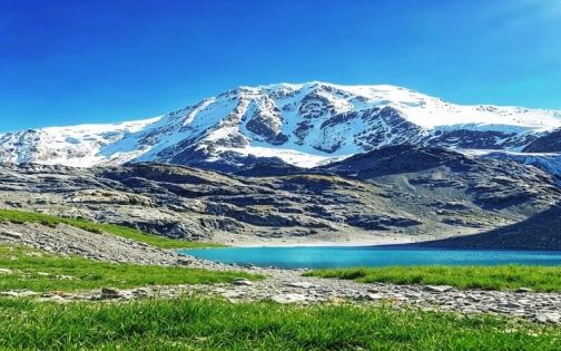
Nyenchen Tanglha Mountains
10. Qiongmu Gangri Glacier: A Hidden Blue Ice World Near Lhasa
Another hidden treasure within the Nyenchen Tanglha Mountains is Qiongmu Gangri Glacier.
Unlike crowded glacier attractions, this place remains relatively unknown.
The biggest attraction is its incredible blue ice scenery.
Under sunlight, the glacier appears deep blue and transparent, creating a dreamlike landscape of:
- Ice towers
- Glacier lakes
- Snow mountains
- High-altitude wilderness
Altitude:
Approximately 5,000–6,000 meters
Main peak:
7,111 meters
Qiongmu Gangri Glacier Travel Tips
Border Permit
Some areas require a border permit.
Foreign visitors and travelers from outside Tibet should confirm requirements before departure.
High Altitude Preparation
The altitude is extreme.
Prepare:
- Oxygen bottles
- Glucose
- Chocolate
- Warm clothing
- Sun protection
Weather Changes Quickly
Mountain weather can change within minutes.
A sunny morning can become snowy in the afternoon.
Never underestimate the environment.
11. Best Seasons to Visit Nyenchen Tanglha Mountains
Spring (March–May)
Rating: ★★★★★
Highlights:
- Bomi peach blossoms
- Lolong apricot blossoms
- Clear snow mountain views
Best for:
Photography and road trips.
Summer (June–August)
Rating: ★★★★☆
Highlights:
- Wildflowers
- Green valleys
- Better hiking conditions
Best for:
Bunang Valley trekking.
Autumn (September–October)
Rating: ★★★★★
Highlights:
- Stable weather
- Clear skies
- Golden forests
- Beautiful snow peaks
One of the best seasons for self-driving.
Winter (November–February)
Rating: ★★★☆☆
Highlights:
- Few tourists
- Snow-covered landscapes
Challenges:
- Icy roads
- More difficult hiking
- Extreme temperatures
Extra preparation is necessary.
12. Essential Packing List for Nyenchen Tanglha Travel
High-altitude Tibet travel requires preparation even during summer.
Clothing
Bring:
- Windproof jacket
- Down jacket
- Thermal underwear
- Gloves and hat
Hiking Equipment
Recommended:
- Hiking shoes
- Trekking poles
- Anti-slip footwear
- Waterproof pants
High-Altitude Supplies
Essential items:
- Sunscreen
- Sunglasses
- Oxygen bottles
- Glucose
- Basic medicine
Electronic Equipment
Bring:
- Power bank
- Car charger
- Spare camera batteries
13. Accommodation Recommendations
Lolong County
The best place to stay along the S303 route.
Options include:
- Oxygen-supported hotels
- Local county hotels
A good place to rest before continuing deeper into Tibet.
Gyari County
If visiting Bunang Valley:
Stay overnight in Gyari town.
Allow your body time to adapt to altitude.
Camping
Wild camping is not recommended unless you have professional experience.
Reasons:
- Very low nighttime temperatures
- Strong winds
- Possible wildlife encounters
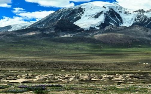
Nyenchen Tanglha Mountains
14. Safety Tips for Traveling in Nyenchen Tanglha Mountains
The biggest attraction of this region is also its biggest challenge:
It remains wild and undeveloped.
Travelers should respect nature and local culture.
Important reminders:
- Avoid entering remote areas alone
- Check weather conditions before hiking
- Do not leave trash behind
- Respect Tibetan religious customs
- Do not climb Mani stones or disturb prayer flags
- Do not approach wild animals
Possible wildlife includes:
- Bears
- Wild animals
- Herd animals
Stay alert during outdoor activities.