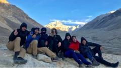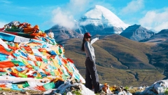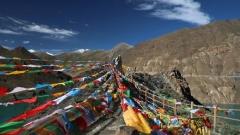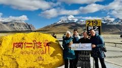

Embarking on a journey to travel to Tibet via the Sichuan-Tibet Highway, commonly known as the G318, is widely considered one of the most spectacular overland adventures on the planet. Stretching from the lush basins of Chengdu to the towering heights of Lhasa, this legendary route covers over 2,100 kilometers of constantly shifting landscapes. You will traverse deep river gorges, cross snow-capped mountain passes exceeding 5,000 meters, and pass through ancient Tibetan villages untouched by time. For those who seek raw natural beauty and profound cultural immersion, the southern route of the G318 offers an unparalleled experience. It is not merely a drive; it is a pilgrimage into the heart of the Himalayas. Proper preparation is essential, as the terrain demands respect, resilience, and a spirit of adventure. Whether you are driving yourself or hiring a local crew, understanding the nuances of this highway will transform a challenging trek into the journey of a lifetime.
Key Takeaways
- Acclimatize gradually to prevent altitude sickness.
- Choose a reliable 4WD vehicle for rough terrain.
- Pack layers for extreme temperature shifts.
- Respect local Tibetan customs and religious sites.
- Secure all necessary travel permits before departure.
Understanding the G318 Route to Travel to Tibet
The Sichuan-Tibet Highway is divided into two main branches: the northern route (G317) and the southern route (G318). When travelers talk about the classic road trip to Lhasa, they are almost always referring to the G318 southern route. This path was originally carved out in the mid-twentieth century to connect Sichuan province with the Tibetan Autonomous Region, and it has since evolved into a world-renowned touring highway.
The journey typically begins in Chengdu, the capital of Sichuan, sitting at an elevation of roughly 500 meters. From here, the road quickly climbs into the western highlands. The first major transition happens as you leave the fertile plains and enter the rugged Hengduan Mountains. Unlike flying directly into Lhasa, which sits at 3,650 meters, traveling overland allows your body to adjust to the increasing elevation step by step. This gradual ascent is one of the primary reasons so many adventurers choose to travel to Tibet via the Sichuan-Tibet Highway rather than taking a flight.
The entire route usually takes between seven to ten days if driven continuously, though many travelers prefer to stretch it to two weeks to allow for hiking, sightseeing, and proper rest. The road conditions have improved dramatically over the past decade. Many of the treacherous dirt tracks have been paved, and massive engineering projects have bored tunnels through mountains that once required grueling, dangerous ascents. However, the sheer scale of the geology means that landslides, rockfalls, and sudden weather changes remain a constant reality.
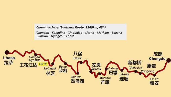
Sichuan-Tibet Highway Map G318
Essential Preparations Before You Travel to Tibet via the Sichuan-Tibet Highway
Preparation is the dividing line between a memorable adventure and a logistical nightmare. Because you are entering remote, high-altitude territory far from major urban centers, every detail matters.
Vehicle Selection and Maintenance
If you are driving your own vehicle or renting one, a four-wheel-drive SUV or off-road vehicle is highly recommended. While standard sedans can technically complete much of the paved G318, the detours, construction zones, and unpaved stretches near certain mountain passes require higher ground clearance and better traction. Ensure your tires are all-terrain and carry at least one full-size spare. Your braking system must be in flawless condition, as you will be navigating endless switchbacks and steep descents where brake fade is a genuine hazard. Carry extra engine oil, coolant, and basic tools. Mechanics are available in larger towns like Kangding, Litang, and Markam, but the distances between them can be vast.
Permits and Documentation
Foreign passport holders cannot simply drive into Tibet independently. You must obtain a Tibet Travel Permit, which is arranged through a registered travel agency. Additionally, an Alien Travel Permit is required for visiting unopened areas outside Lhasa. If you plan to visit Mount Everest Base Camp or other restricted border regions, a Military Area Entry Permit is also necessary. Chinese citizens need their ID cards, while residents of Hong Kong, Macau, and Taiwan have specific permit requirements. It is crucial to organize these documents well in advance, as bureaucratic processing times can vary.
Physical Fitness and Altitude Awareness
Altitude sickness, or Acute Mountain Sickness (AMS), is the greatest physical challenge when you travel to Tibet via the Sichuan-Tibet Highway. Symptoms include headaches, nausea, dizziness, and shortness of breath. To mitigate this, avoid strenuous exercise in the days leading up to the trip. Consult your doctor about carrying acetazolamide (Diamox) to aid acclimatization. Once on the road, drink plenty of water, avoid alcohol, and do not rush your itinerary. If symptoms become severe, descending to a lower altitude immediately is the only safe option.
The Journey Begins: From Chengdu to Kangding
Leaving Chengdu, the modern expressway swiftly carries you toward Ya’an, famously known as the “Rain City” due to its high precipitation. The landscape here is intensely green, characterized by tea plantations and bamboo forests. As you continue westward, the Erlang Mountain Tunnel marks a psychological threshold; passing through it feels like stepping into another world. The humid, low-altitude air of the Sichuan basin gives way to cooler, crisper mountain breezes.
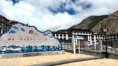
Luding is your next notable stop, famous for the Luding Bridge, a historical iron-chain suspension bridge spanning the roaring Dadu River. It is a brief but fascinating historical detour. Shortly after, the road begins its serious climb toward Kangding, the traditional gateway to the Kham Tibetan region. Kangding sits at around 2,500 meters and serves as an excellent first overnight stop. The town is a vibrant mix of Han Chinese and Tibetan cultures. Walking along the Zhequ River that splits the town, you can hear traditional folk songs and smell the rich aroma of yak butter tea wafting from local teahouses. Spending a night here allows your body its first meaningful adjustment to the altitude before tackling the higher passes ahead.
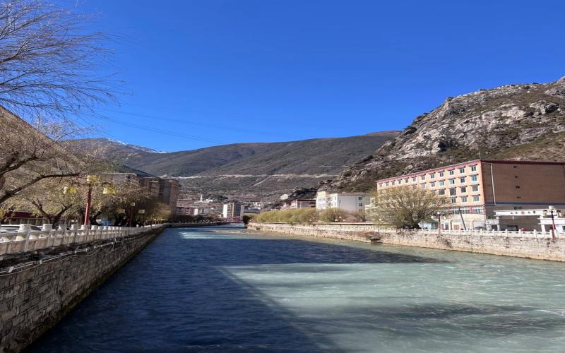
Kangding
Conquering the High Passes: Kangding to Litang
The stretch between Kangding and Litang is where the true nature of the G318 reveals itself. Leaving Kangding, you immediately begin the ascent toward Zheduo Mountain Pass, which stands at 4,298 meters. This is often the first major test for travelers. The road winds tightly, and weather can shift from bright sunshine to blinding snowstorms within minutes, even in warmer months. Once over Zheduo Pass, you descend into Xinduqiao, widely celebrated as a photographer’s paradise. In autumn, the poplar trees turn brilliant shades of gold against the backdrop of rolling hills, meandering streams, and distant snowy peaks.
From Xinduqiao, the route pushes higher toward Gaolersi Temple and the expansive grasslands of Tagong. Here, you get your first clear views of Yala Snow Mountain, a sacred peak that dominates the horizon. The road then climbs relentlessly toward Litang, crossing several passes above 4,000 meters. Litang itself sits at a staggering 4,014 meters, making it one of the highest towns in the world. Known as the “City in the Sky,” Litang is deeply significant in Tibetan culture, being the birthplace of several prominent Dalai Lamas and home to the grand Litang Chöde Monastery. The annual horse racing festival held on the surrounding grasslands is a spectacular display of Kham Tibetan horsemanship and nomadic tradition. Staying in Litang requires careful attention to hydration and rest, as the thin air makes even walking up a flight of stairs feel exhausting.
Crossing the Jinsha River into the Tibetan Autonomous Region
Departing Litang, the road descends through the Haizi Mountain Nature Reserve, a surreal landscape dotted with thousands of glacial lakes reflecting the sky. The descent continues into Batang, a surprisingly warm and lush valley nestled along the Jinsha River. Batang is famous for its apples and relaxed pace of life, offering a welcome respite from the high-altitude chill.
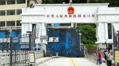
The Jinsha River forms the natural boundary between Sichuan province and the Tibetan Autonomous Region. Crossing the bridge here is a momentous occasion for anyone undertaking this journey. Upon crossing, you enter Markam, the first county in Tibet. It is here that your Tibet Travel Permits will be rigorously checked by authorities. Markam is also the junction where the Yunnan-Tibet Highway (G214) merges with the G318. The landscape shifts again, characterized by dramatic red earth cliffs and deep river valleys. The roads in this section are prone to landslides during the summer rainy season, so checking local traffic updates is essential.
The Treacherous Beauty of the 72 Turns and Nujiang Valley
Continuing westward from Markam, the route climbs over Dongda Mountain Pass, reaching an elevation of over 5,100 meters, the highest point on the entire G318. The air here is incredibly thin, and the views are starkly beautiful. Descending from Dongda, you arrive in Zogang and then push toward Basu.
The approach to Basu involves navigating the infamous “72 Turns” (also known as the Nujiang 72拐) near Bangda. This section of the road is a marvel of engineering and a test of nerves. The highway zigzags down the face of a massive gorge, dropping thousands of meters in elevation over a very short horizontal distance. Drivers must use low gears to control their speed, relying on engine braking rather than riding the brakes, which can overheat and fail. At the bottom lies the Nujiang River valley, a dry, wind-swept canyon that contrasts sharply with the snowy peaks above. The descent into Ranwu offers a dramatic change in scenery, leading to the stunning Ranwu Lake. Fed by glaciers, the lake’s color shifts from turquoise to deep blue depending on the season and light, surrounded by dense forests and the majestic Galongla Glacier.
Glaciers, Forests, and the Swiss Alps of Tibet: Bomi to Nyingchi
Many travelers are surprised to find that eastern Tibet is not just barren plateau, but a region of immense biodiversity. The stretch from Bomi to Nyingchi is often referred to as the “Swiss Alps of Tibet.” Bomi is blanketed in dense, primeval forests, nourished by the moisture carried up the Yarlung Tsangpo river gorge from the Indian subcontinent.
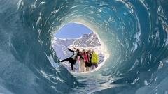
A major highlight here is the Midui Glacier, one of the few marine glaciers in the world that extends down into a forested area. The sight of massive icefalls hovering just above green pine trees is visually striking. As you continue toward Nyingchi, you will pass through the Tongmai nature reserve. Historically, Tongmai was the most dangerous bottleneck on the G318, featuring rickety suspension bridges and narrow cliffside tracks. Today, massive modern bridges and tunnels have bypassed the worst sections, though the surrounding landscape remains wild and untamed.
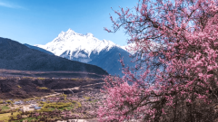
Nyingchi, sitting at a relatively comfortable 2,900 meters, is a haven for weary travelers. The oxygen levels are noticeably higher, allowing for deep, restful sleep. If you travel in spring, the Nyingchi Peach Blossom Festival transforms the valleys into seas of pink flowers set against snow-capped backdrops. The nearby Sejila Mountain Pass offers breathtaking views of Namcha Barwa, the 7,782-meter peak that pierces the clouds and guards the great bend of the Yarlung Tsangpo River.
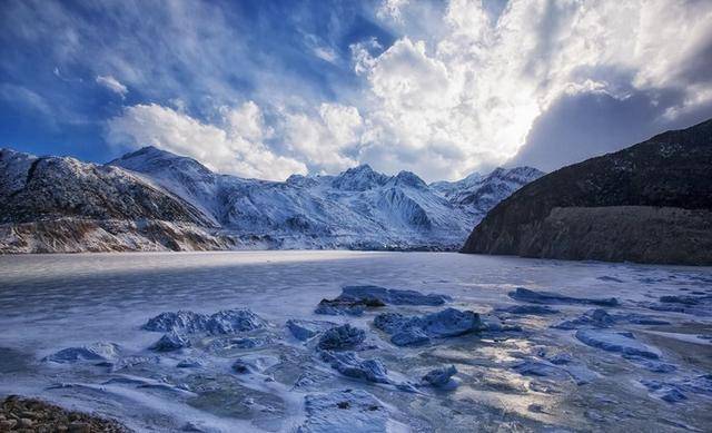
Midui Glacier
The Final Stretch: Nyingchi to Lhasa
The final leg of your journey to Lhasa has been transformed by the opening of the Nyingchi-Lhasa expressway. While hardcore purists might miss the slow, winding older roads, the new highway significantly reduces travel time and fatigue. The route follows the Nyang River before merging with the Yarlung Tsangpo valley. The scenery transitions from dense forests back to the classic high-altitude scrubland of the central Tibetan plateau.
As you approach Lhasa, the anticipation builds. The first glimpse of the Potala Palace rising above the city skyline is a moment etched into the memory of every traveler. Arriving in the capital after days of grueling, awe-inspiring driving brings a profound sense of accomplishment. Lhasa offers everything from the spiritual intensity of the Jokhang Temple and Barkhor Street to the comfort of modern hotels and diverse dining options. You have finally completed your quest to travel to Tibet via the Sichuan-Tibet Highway.
Packing Essentials for the G318 Overland Trip
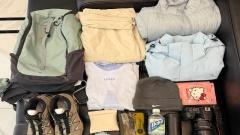
Packing for this route requires balancing preparedness with space constraints. Temperatures can swing from freezing at dawn to scorching under the midday sun at high altitudes. Layering is the golden rule.
- Clothing: Thermal base layers, fleece jackets, a waterproof and windproof outer shell, and durable hiking pants. A heavy down jacket is necessary for evenings, even in summer.
- Footwear: Sturdy, broken-in hiking boots for exploring off-road, and comfortable shoes for driving.
- Health and Safety: A comprehensive first-aid kit including bandages, antiseptics, pain relievers, anti-diarrhea medication, and altitude sickness pills. Portable oxygen cans are highly recommended and easily purchased in Chengdu or Kangding.
- Sun Protection: The UV radiation at high altitudes is intense. Bring high-SPF sunscreen, polarized sunglasses, lip balm with SPF, and wide-brimmed hats.
- Electronics: Power banks, car chargers, and adapters. Signal can be spotty in remote gorges, so downloading offline maps is critical.
- Food and Water: Keep a stash of high-energy snacks like nuts, chocolate, and dried fruit. Bottled water should be consumed regularly to stay hydrated.
Cultural Etiquette and Responsible Tourism
When you travel to Tibet via the Sichuan-Tibet Highway, you are passing through the ancestral lands of the Khampa people and entering the heart of Tibetan Buddhism. Respecting local customs is not just polite; it is essential for a harmonious journey.
Always walk clockwise around Buddhist monasteries, stupas, and mani stone piles. Never touch a Tibetan person on the head, as it is considered sacred. When visiting temples, dress modestly—avoid shorts, tank tops, and revealing clothing. Ask for permission before photographing locals, especially monks and elderly residents; a smile and a gesture go a long way. Do not photograph military installations or bridges, as this is strictly prohibited and can lead to confiscation of equipment or detention.
Environmental responsibility is equally crucial. The fragile alpine ecosystem recovers very slowly from damage. Carry out all your trash. Do not litter in rivers or on grasslands. Stick to established trails when hiking to avoid damaging delicate vegetation.
Navigating Challenges with China Dragon Travel
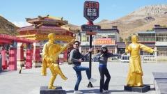
While the independence of a self-driven road trip appeals to many, the logistical complexities of permits, language barriers, unpredictable road conditions, and altitude management make guided tours a safer and more enriching choice for many international visitors. This is where experienced operators prove invaluable. Agencies like China Dragon Travel specialize in facilitating seamless journeys along the G318. They handle the intricate process of securing Tibet Travel Permits, provide seasoned drivers who intimately know the quirks of every mountain pass, and supply reliable, well-maintained vehicles equipped for extreme terrain. Furthermore, traveling with knowledgeable guides ensures you understand the deep historical and spiritual context of the monasteries, landscapes, and communities you encounter, transforming a simple road trip into a deeply educational expedition. Utilizing professional services removes the stress of logistics, allowing you to focus entirely on the breathtaking experience of the journey.
Best Seasons for the Journey
Timing your trip correctly dictates the quality of your experience. The optimal windows to travel to Tibet via the Sichuan-Tibet Highway are late spring (May to early June) and autumn (September to October).
During May and June, the winter snows have largely melted from the lower passes, the valleys are blooming with rhododendrons and peach blossoms, and the weather is generally stable. However, as July approaches, the monsoon season begins. Summer (July and August) brings heavy rainfall, which drastically increases the risk of landslides, mudslides, and road washouts, particularly in the Nujiang and Yarlung Tsangpo valleys. While the landscape is incredibly lush during this time, the driving hazards are significantly elevated.
Autumn offers the most stable weather. September and October bring crisp, clear skies, offering the best visibility for viewing distant snow peaks like Namcha Barwa and Gongga. The forests turn spectacular shades of yellow, orange, and red. By November, heavy snowfall begins to close the highest passes, making winter travel extremely dangerous and generally inadvisable for all but the most experienced expedition teams.
The Psychological Reward of the G318
To travel to Tibet via the Sichuan-Tibet Highway is to engage in a profound dialogue with nature and oneself. The sheer scale of the Himalayas, the relentless altitude, and the ever-changing road conditions strip away the comforts of modern urban life. What remains is a heightened sense of presence. Every mountain pass conquered, every prayer flag fluttering in the alpine wind, and every shared pot of tea in a roadside village adds a layer of meaning to the journey. The G318 is not just a route on a map; it is a testament to human endurance and the enduring allure of the unknown. Those who complete it return not just with photographs, but with a permanently shifted perspective on what it means to explore the world.